
CHICAGOLAND DETAILS …
A thunderstorm cell that was on track to strike Frontier Days about 3:25 p.m., then stalled
Radar indicated precipitation in the form of a line of thunderstorm cells from Mundelein to Peoria at 2:45 p.m. moving west to east. A thunderstorm cell near Crystal Lake and Elgin had moderate lightning, and was moving toward Arlington Heights, and was likely to strike the Frontiers Day festival at some time between 3:20 p.m. and 3:40 p.m. On approach to Arlington Heights, the storm did not increase in intensity, but the storm also stalled in an area from Schaumburg to Elgin where there has been some flooding. The storm also fluctuated in size just west of Arlington Heights.
Storms near Naperville and Aurora to Streator contain more frequent lightning.
A Severe Thunderstorm Warning was activated for Aurora, Batavia, Big Rock, Oswego, and Yorkville at 2:42 p.m.
A Severe Thunderstorm Warning was activated for Naperville, Wheaton, Lombard, Woodridge, Burr Ridge, Bolingbrook, Romeoville, Plainfield, Lockport, Homer Glen, New Lenox, Shorewood, Joliet, and Channahon at 3:19 p.m.
A Flash Flood Warning, which included Rolling Meadows, was issued at 3:08 p.m. and Arlington Heights could be next in line to get a Flash Flood Warning.
Due to anticipated severe weather moving into the area, all festival operations will close at 2:30 PM today as a precaution for the safety of our guests, vendors, and staff.
We are actively monitoring the situation and anticipate reopening around 5:00 PM, weather permitting. We’ll continue to post updates here as conditions develop.
Please plan accordingly, seek appropriate shelter if you’re on-site, and thank you for your patience and cooperation. Your safety is our top priority.
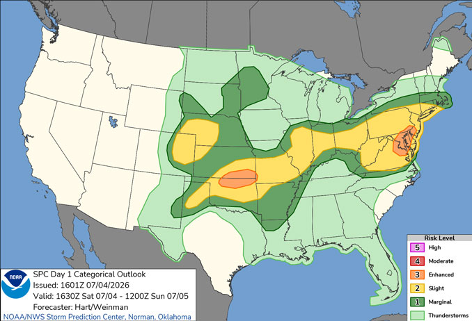
Thunderstorms will move across the area today. Coverage of storms will be highest mid-afternoon through about 8 or 9 PM (ending from west to east).
Locally damaging winds and very heavy rainfall are the main threats with a pronounced threat for flash flooding particularly in the western and southern Chicago metropolitan area.
Sunday will feature a few showers and storms largely south of I-80. Coverage and intensity will be far less compared to the past few days.
Drier and more seasonable conditions expected to start the week before stormier weather returns late week.
WATCHES, WARNINGS, ADVISORIES
Severe Thunderstorm Watch
Severe Thunderstorm Warnings in the area
Flood Watch
See also: LIVE STREAMS: Arlingtoncardinal.com/StormChasers
Temperature Outlook …
SU 66 78 | M 66 78 | T 64 83 | W 67 89
O’HARE FORECAST …
Flood Watch until July 4, 10:00 PM CDT
Severe Thunderstorm Watch in effect from July 4, 12:35 PM CDT until July 4, 07:00 PM CDT
Independence Day (Saturday): Showers and thunderstorms, mainly after 3pm. Some of the storms could be severe. High near 84. North northeast wind around 5 mph, with gusts as high as 10 mph. Chance of precipitation is 100%. New rainfall amounts of less than a tenth of an inch, except higher amounts possible in thunderstorms.
Saturday Night: Showers and thunderstorms, mainly before 10pm. Some of the storms could be severe. Low around 66. North wind around 5 mph. Chance of precipitation is 80%. New rainfall amounts of less than a tenth of an inch, except higher amounts possible in thunderstorms.
Sunday: Isolated showers and thunderstorms between 1pm and 4pm. Cloudy, then gradually becoming mostly sunny, with a high near 78. Northeast wind 5 to 10 mph. Chance of precipitation is 20%.
Sunday Night: Partly cloudy, with a low around 66. North northeast wind 5 to 10 mph, with gusts as high as 15 mph.
Monday: Sunny, with a high near 78. Northeast wind 5 to 10 mph, with gusts as high as 15 mph.
Monday Night: Mostly clear, with a low around 64.
Tuesday: Sunny, with a high near 83.
Tuesday Night: Mostly clear, with a low around 67.
Wednesday: Sunny, with a high near 89.
Wednesday Night: A chance of showers and thunderstorms after 1am. Partly cloudy, with a low around 70.
Thursday: Showers likely and possibly a thunderstorm. Partly sunny, with a high near 88.
Thursday Night: Showers likely. Mostly cloudy, with a low around 67.
RADAR • Clouds • Temps • NWS CHGO • UV
O’Hare Weather Forecast SAT JUL 04, 2026 2:42 PM SOURCE: National Weather Service local offices.
