

A tornado is possible Friday night in Chicagoland, but the greater tornado threat is northwest of Chicagoland. There greater threat in Chicagoland, O’Hare and Arlington Heights involves damaging thunderstorm winds, heavy rain and flooding of saturated ground.
Dense fog around parts of the area this morning, especially around Lake Michigan, cleared out, leaving partly sunny conditions with mostly sunny skies expected during the greatest potential heating time period of the day.
Another round of showers and thunderstorms is expected later this evening into tonight after mostly cloudy conditions start moving in around 6:00 p.m. Some of the storms could be severe, and the peak time for severe weather is between 9:00 p.m. and midnight. Locally heavy rainfall could result in flooding issues. The entire rain period is possibly from 9:00 p.m. Friday to 9:00 am. Saturday.
Windy and unseasonably warm weather today will be replaced by much colder weather over the weekend into early next week.
Frost/freeze conditions are expected many areas Sunday and especially Monday mornings.
Weather Radar at 10:20 a.m. in northeast Illinois was clear.
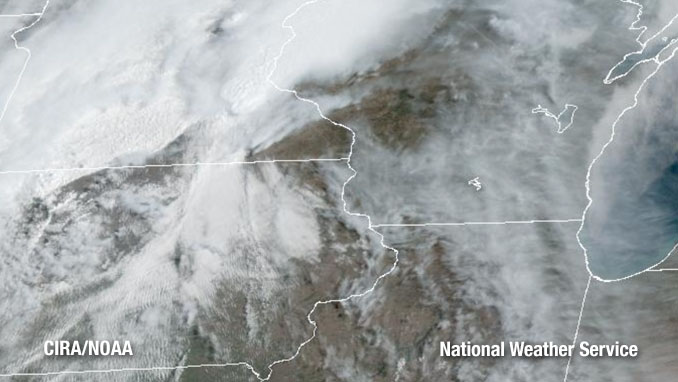
Cloud cover indicates clearing skies, allowing good heating potential between 11:00 a.m. and 5:00 p.m.
See also Arlingtoncardinal.com/clouds
O’HARE FORECAST …
Friday: Mostly sunny skies between 11am and 5pm, with a high near 81 around 3pm to 4pm. Breezy, with a south wind 10 to 20 mph, with gusts as high as 30 mph. Non-thunderstorm gusts will peak about 2:00 p.m. to 4:00 p.m. then higher thunderstorm gusts are likely between 9:00 p.m and midnight.
Friday Night: Showers and thunderstorms possible after 6:00 p.m., but most likely between 9:00 p.m. and midnight when an arriving cold front could bring severe weather. Breezy, with a south wind 15 to 20 mph becoming west after midnight. Winds at 2:00 p.m. could gust as high as 30 mph and continue into Saturday afternoon, but higher thunderstorm gusts are likely between 9:00 p.m and midnight during intense thunderstorms Friday before midnight. Chance of precipitation is 100%. New rainfall amounts between a half and three quarters of an inch possible. Saturday morning low around 44-45 from 8:00 a.m. to 9:00 a.m.
Saturday: A 20 percent chance of showers before 10am. Cloudy, then gradually becoming mostly sunny, with a steady temperature around 45. Breezy, with a west northwest wind 15 to 20 mph, with gusts as high as 30 mph.
Saturday Night: Mostly clear, with a low around 36. West northwest wind 10 to 15 mph, with gusts as high as 25 mph.
Sunday: Mostly sunny, with a high near 50. West northwest wind 10 to 15 mph, with gusts as high as 25 mph.
Sunday Night: Areas of frost after 5am. Otherwise, mostly clear, with a low around 35.
Monday: Areas of frost before 7am. Otherwise, sunny, with a high near 56.
Monday Night: Partly cloudy, with a low around 47.
Tuesday: Partly sunny, with a high near 73.
Tuesday Night: Partly cloudy, with a low around 52.
Wednesday: Mostly sunny, with a high near 72.
Wednesday Night: Partly cloudy, with a low around 52.
Thursday: Mostly sunny, with a high near 77.
LAKE TEMPS …
Southern Lake Michigan Water Temperatures
National Weather Service Chicago/Romeoville IL
906 AM CDT Fri Apr 17 2026
Lake Michigan Water Temperatures…
Chicago Shore………..51.
Chicago Crib…………49.
Waukegan Buoy………..48.
Winthrop Harbor Buoy….44.
Michigan City………..48.
South Mid Lake Buoy…..38.
&&
M is for missing data that is normally available. Chicago Shore,
Chicago Crib, and Michigan City are read every day of the year.
Measured at a depth of 60 ft for Chicago Crib and 30 ft for Michigan City. May not represent surface temperature.
april.chicagoweatherstation.com
Chicago Weather Forecast for your MAC/PC/TABLET includes surrounding suburbs.
^^ MOBILE? USE VOICE MIC ^^
facebook …
Please ‘LIKE’ the ‘Arlington Cardinal Page. See all of The Cardinal Facebook fan pages at Arlingtoncardinal.com/about/facebook …
Help fund The Cardinal Arlingtoncardinal.com/sponsor
