
Reverse Surge on Wednesday, 09-28-2022 Port Charlotte, FL … Hurricane Ian – Negative Surge in Charlotte Harbor (Live Storms Media) YouTube Tips ⓘ
Ocean water is receding at Charlotte Harbor ahead of the landfall of Hurricane Ian. Storm chaser posted video of erosion and water moving west toward the ocean. The Florida Division of Emergency Management warned that receding water in Charlotte Harbor and Tampa Bay will return through storm surge. Hurricane Ian was located about 55 miles west of Naples, Florida when the receding water was observed. Storm surge of up to 18 feet is possible near Charlotte Harbor.
Reverse surge is a term for water that drains from an area before water comes back to shore causing danger on roadways and buildings that can become covered with deep water.
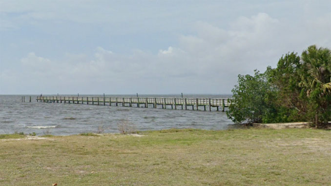
Charlotte Harbor is going in reverse… pic.twitter.com/3XX34rptwS
— Brett Adair (@AlaStormTracker) September 28, 2022
https://twitter.com/FLSERT/status/1575115346696077315
The forecast for Charlotte Harbor, Florida included a Flood Watch, Hurricane Warning, Tornado Watch, and a Storm Surge Warning.
With the Storm Surge Warning is a statement declaring Life-threatening and historic storm surge possible with the potential for water levels 12-18 feet above ground somewhere within surge prone areas through Friday evening.
^^ MOBILE? USE VOICE MIC ^^
facebook …
Please ‘LIKE’ the ‘Arlington Cardinal Page. See all of The Cardinal Facebook fan pages at Arlingtoncardinal.com/about/facebook …
Help fund The Cardinal Arlingtoncardinal.com/sponsor
20240105-1435future
Hurricane Ian Local Statement Intermediate Advisory Number 23A FLZ043-050-052-056-057-061-139-142-148-149-151-155-160-162-165-239-242-248-249-251-255-260-262-265-282130-
Hurricane Ian Local Statement Intermediate Advisory Number 23A National Weather Service Tampa Bay Ruskin FL AL092022 930 AM EDT Wed Sep 28 2022
This product covers West Central and Southwest Florida
**IAN EXPECTED TO CAUSE CATASTROPHIC STORM SURGE, WINDS, AND FLOODING IN THE FLORIDA PENINSULA STARTING LATER TODAY**
NEW INFORMATION —————
* CHANGES TO WATCHES AND WARNINGS: – None
* CURRENT WATCHES AND WARNINGS:
– A Storm Surge Warning and Hurricane Warning are in effect for Coastal Charlotte, Coastal Hillsborough, Coastal Lee, Coastal Manatee, Coastal Sarasota, Inland Lee, and Pinellas
– A Hurricane Warning is in effect for DeSoto, Hardee, Highlands, Inland Charlotte, Inland Hillsborough, Inland Manatee, Inland Sarasota, and Polk
– A Storm Surge Warning and Tropical Storm Warning are in effect for Coastal Citrus, Coastal Hernando, Coastal Levy, and Coastal Pasco
– A Tropical Storm Warning is in effect for Inland Citrus, Inland Hernando, Inland Levy, Inland Pasco, and Sumter
* STORM INFORMATION:
– About 70 miles southwest of Fort Myers FL or about 90 miles south of Sarasota FL
– 26.0N 82.7W
– Storm Intensity 155 mph
– Movement North-northeast or 15 degrees at 10 mph
SITUATION OVERVIEW ——————
Hurricane Ian continues as a category 4 hurricane. Have increased the surge potential across Charlotte and Lee county coastlines. Ian continues to lift off to the north-northeast at 10mph and is expected to make landfall along the west coast of Florida later today. Numerous local impacts are expected with watches and warnings continuing across the area. Residents should hunker down for the duration of the storm.
POTENTIAL IMPACTS —————–
* SURGE: Potential impacts from the main surge event are now unfolding across southwest Florida. Remain well away from life-threatening surge having possible catastrophic impacts. If realized, these impacts include: – Widespread deep inundation, with storm surge flooding greatly accentuated by powerful battering waves. Structural damage to buildings, with many washing away. Damage greatly compounded from considerable floating debris. Locations may be uninhabitable for an extended period. – Near-shore escape routes and secondary roads washed out or severely flooded. Flood control systems and barriers may become stressed. – Extreme beach erosion. New shoreline cuts possible. – Massive damage to marinas, docks, boardwalks, and piers. Numerous small craft broken away from moorings with many lifted onshore and stranded.
Potential impacts from the main surge event are also now unfolding across Tampa Bay and the Nature Coast. Remain well away from life-threatening surge having possible significant to devastating impacts.
* WIND: Protect against life-threatening wind having possible devastating impacts across west central and southwest Florida. Potential impacts in this area include:
– Structural damage to sturdy buildings, some with complete roof and wall failures. Complete destruction of mobile homes. Damage greatly accentuated by large airborne projectiles. Locations may be uninhabitable for weeks or months.
– Numerous large trees snapped or uprooted along with fences and roadway signs blown over.
– Many roads impassable from large debris, and more within urban or heavily wooded places. Many bridges, causeways, and access routes impassable.
– Widespread power and communications outages.
* FLOODING RAIN: Protect against life-threatening rainfall flooding having possible devastating impacts across west central and southwest Florida. Potential impacts include:
– Extreme rainfall flooding may prompt numerous evacuations and rescues.
– Rivers and tributaries may overwhelmingly overflow their banks in many places with deep moving water. Small streams, creeks, canals, and ditches may become raging rivers. Flood control systems and barriers may become stressed.
– Flood waters can enter numerous structures within multiple communities, some structures becoming uninhabitable or washed away. Numerous places where flood waters may cover escape routes. Streets and parking lots become rivers of raging water with underpasses submerged. Driving conditions become very dangerous. Numerous road and bridge closures with some weakened or washed out.
* TORNADOES: Protect against a dangerous tornado event having possible significant impacts across west central and southwest Florida. Potential impacts include:
– The occurrence of scattered tornadoes can hinder the execution of emergency plans during tropical events.
– Several places may experience tornado damage with a few spots of considerable damage, power loss, and communications failures.
– Locations could realize roofs torn off frame houses, mobile homes demolished, boxcars overturned, large trees snapped or uprooted, vehicles tumbled, and boats tossed about. Dangerous projectiles can add to the toll.
PRECAUTIONARY/PREPAREDNESS ACTIONS ————————-
* EVACUATIONS: Do not enter evacuated areas until officials have given the all clear to return.
* OTHER PREPAREDNESS INFORMATION: Now is the time to stay inside and away from windows. Listen for updates and be ready in case you lose electrical power. Keep a battery- powered radio, charged cell phone and flashlight handy.
During the peak of the storm be ready to move quickly. Keep your shoes on and rain gear handy. Boots and athletic shoes offer the best foot protection if you become unexpectedly exposed to the weather.
Keep your cell phone charged and in power-saving mode. If you lose power, use it sparingly and mainly for personal emergencies and check-ins.
Do not venture outside while in the eye of a hurricane as any improvement in weather will only be temporary. Once the eye passes, conditions will become life threatening as winds immediately return to dangerous speeds, so remain safely sheltered from the storm.
Do not be a thrill seeker or risk your life for senseless photos or videos.
Quickly move to the safest place within your shelter if it begins to fail, preferably an interior room on the lowest floor as long as flooding is not a concern.
If you are prone to flooding or in an area under a storm surge watch or warning, be prepared for the possibility of a quick and dramatic rise in water levels.
If a tornado warning is issued for your area, quickly move to the safest place within your shelter. Protect your head and body.
If an Extreme Wind Warning is issued for your area, move to the safest place within your shelter. Take the same life-saving actions as if it were a violent tornado.
* ADDITIONAL SOURCES OF INFORMATION: – For information on appropriate preparations see ready.gov – For information on creating an emergency plan see getagameplan.org – For additional disaster preparedness information see redcross.org
NEXT UPDATE ———–
The next local statement will be issued by the National Weather Service in Tampa Bay Ruskin FL around 12 PM EDT, or sooner if conditions warrant.
