
CHICAGOLAND DETAILS …
Radar indicates precipitation as a line of severe thunderstorms from about Milwaukee to Peoria that will pass through Arlington Heights and O’Hare International Airport by about 1:15 p.m.
Hot and humid conditions will continue today, though the highest heat indices around 100 degrees will likely focus near/south of the Kankakee River. On Independence Day, peak heat indices of about 95-100F are expected near and south of I-80.
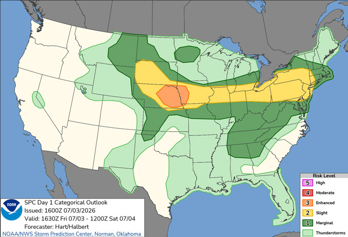
Waves of thunderstorms are expected through the weekend, though there will be many dry hours. Any storms today will be capable of producing damaging winds. There will also be a threat for localized flash flooding with any focused corridors of storms through the weekend.
Multiple photos and reports of downed trees and power lines in and around Rockton, Illinois including near MacTown Forest Preserve and Settlers Park in Winnebago County.
Multiple victims are missing in the water near Hollybush Drive in Lake Geneva after boat capsized during stormy weather.
Multiple victims of a silo collapse that occurred during stormy weather in the block of 2200 Highway 14 in Darien, Wisconsin.
WATCHES, WARNINGS, ADVISORIES
Severe Thunderstorm Warning in the area
Severe Thunderstorm Watch in the area
See also: LIVE STREAMS: Arlingtoncardinal.com/StormChasers
Temperature Outlook …
SA 74 88 | SU 71 84 | M 67 81 | T 64 84
O’HARE FORECAST …
Severe Thunderstorm Watch in effect from July 3, 11:55 AM CDT until July 3, 07:00 PM CDT
Severe Thunderstorm Warning in effect from July 3, 01:05 PM CDT until July 3, 01:45 PM CDT
Friday Afternoon: Showers and thunderstorms, mainly before 3pm. Some of the storms could be severe. High near 88. Heat index values as high as 97. West southwest wind around 10 mph, with gusts as high as 15 mph. Chance of precipitation is 80%. New rainfall amounts of less than a tenth of an inch, except higher amounts possible in thunderstorms.
Friday Night: Scattered showers and thunderstorms. Some of the storms could be severe. Mostly cloudy, with a low around 74. West southwest wind around 5 mph becoming south in the evening. Winds could gust as high as 15 mph. Chance of precipitation is 50%.
Independence Day: Scattered showers and thunderstorms. Mostly sunny, with a high near 88. Heat index values as high as 95. West wind 5 to 10 mph becoming southeast in the afternoon. Chance of precipitation is 50%.
Saturday Night: Scattered showers and thunderstorms. Mostly cloudy, with a low around 71. East southeast wind 5 to 10 mph becoming west in the evening. Chance of precipitation is 50%.
Sunday: Scattered showers and thunderstorms. Partly sunny, with a high near 84. West northwest wind 5 to 10 mph, with gusts as high as 15 mph. Chance of precipitation is 30%.
Sunday Night: Isolated showers and thunderstorms before 10pm, then isolated showers between 10pm and 1am. Partly cloudy, with a low around 67. Chance of precipitation is 20%.
Monday: Mostly sunny, with a high near 81.
Monday Night: Partly cloudy, with a low around 64.
Tuesday: Mostly sunny, with a high near 84.
Tuesday Night: Mostly clear, with a low around 66.
Wednesday: Mostly sunny, with a high near 88.
Wednesday Night: Partly cloudy, with a low around 68.
RADAR • Clouds • Temps • NWS CHGO • UV
O’Hare Weather Forecast FRI JUL 03, 2026 12:52 PM SOURCE: National Weather Service local offices.
