


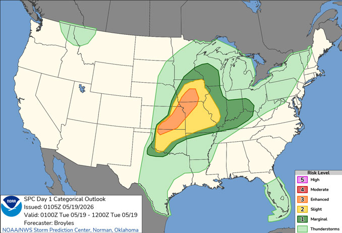
CHICAGOLAND DETAILS …
A period of showers and embedded thunderstorms is expected after midnight tonight through early Tuesday morning, some of which could be locally strong, mainly west of I-55.
Additional thunderstorms may redevelop Tuesday afternoon, mainly east of I-55, some of which could be strong to severe.
Summer-like warmth and breezy winds will prevail through Tuesday, then cooler temperatures and dry conditions will return for the middle of the week.
Milder weather returns Saturday and Sunday with intermittent shower/thunderstorm potential.
See also: LIVE STREAMS: Arlingtoncardinal.com/StormChasers
O’HARE FORECAST …
Overnight Monday/Tuesday: A slight chance of showers between 2am and 3am, then a chance of showers and thunderstorms after 3am. Cloudy, with a low around 67 about 6am to 7am. South southwest wind around 15 mph, with gusts as high as 25 mph all night. Chance of precipitation is 40%.
Tuesday: A 30 percent chance of showers and thunderstorms, mainly between 1pm and 4pm. Cloudy, with a high near 79 about 1pm to 2pm. Breezy, with a south southwest wind 15 to 20 mph becoming west in the afternoon. Winds could gust as high as 30 mph.
Tuesday Night: Mostly cloudy, with a low around 49. Northwest wind 10 to 15 mph, with gusts as high as 20 mph.
Wednesday: Mostly sunny, with a high near 58. Northeast wind 10 to 15 mph, with gusts as high as 20 mph.
Wednesday Night: Partly cloudy, with a low around 44. Northeast wind 5 to 15 mph, with gusts as high as 20 mph.
Thursday: Mostly sunny, with a high near 61.
Thursday Night: Mostly cloudy, with a low around 48.
Friday: A chance of showers. Mostly cloudy, with a high near 64.
Friday Night: A chance of showers. Mostly cloudy, with a low around 52.
RADAR • Clouds • Temps • NWS CHGO • UV

PHOENIX FORECAST …
Monday Night: Clear, with a low around 65. West wind around 5 mph becoming calm in the evening.
Tuesday: Sunny, with a high near 91. Calm wind becoming west around 5 mph in the afternoon.
Tuesday Night: Mostly cloudy, with a low around 68. West wind around 5 mph becoming calm in the evening.
Wednesday: Mostly sunny, with a high near 93. Calm wind becoming west southwest around 5 mph in the afternoon.
Wednesday Night: Clear, with a low around 68. West wind around 5 mph becoming calm in the evening.
Thursday: Sunny, with a high near 95. Calm wind becoming south southwest around 5 mph in the afternoon.
Thursday Night: Mostly clear, with a low around 69. West wind around 5 mph becoming calm after midnight.
Friday: Sunny, with a high near 96. Calm wind becoming west around 5 mph in the afternoon.
Friday Night: Clear, with a low around 70. West wind 5 to 10 mph becoming light after midnight.
RADAR • Clouds • Temps • NWS Phoenix • UV

MIAMI FORECAST …
Rip Current Statement
240 AM EDT Tue May 19 2026
HIGH RIP CURRENT RISK NOW IN EFFECT THROUGH WEDNESDAY EVENING for Coastal Broward County-Coastal Miami Dade County
Overnight: A 20 percent chance of showers and thunderstorms. Partly cloudy, with a low around 78. East wind around 11 mph, with gusts as high as 21 mph.
Tuesday: A 50 percent chance of showers and thunderstorms, mainly before 2pm. Mostly sunny, with a high near 86. East wind 10 to 14 mph, with gusts as high as 21 mph. New rainfall amounts of less than a tenth of an inch, except higher amounts possible in thunderstorms.
Tuesday Night: A slight chance of showers and thunderstorms before 11pm, then a slight chance of showers between 11pm and 2am, then a chance of showers and thunderstorms after 2am. Partly cloudy, with a low around 79. East wind 8 to 10 mph, with gusts as high as 18 mph. Chance of precipitation is 30%.
Wednesday: A 30 percent chance of showers and thunderstorms, mainly before 11am. Sunny, with a high near 87. East wind 8 to 13 mph, with gusts as high as 18 mph.
Wednesday Night: A slight chance of showers and thunderstorms before 11pm, then a slight chance of showers between 11pm and 2am. Mostly clear, with a low around 79. East wind 6 to 9 mph. Chance of precipitation is 20%.
Thursday: A slight chance of showers between 8am and 11am, then a slight chance of showers and thunderstorms after 11am. Sunny, with a high near 87. East wind 5 to 10 mph. Chance of precipitation is 20%.
Thursday Night: Mostly clear, with a low around 79. East wind 7 to 10 mph.
Friday: A 30 percent chance of showers and thunderstorms after 2pm. Sunny, with a high near 88. East wind 6 to 11 mph.
Friday Night: A chance of showers and thunderstorms before 2am, then a slight chance of showers. Partly cloudy, with a low around 80. East wind 7 to 10 mph. Chance of precipitation is 30%.
RADAR • Clouds • Temps • NWS Miami • UV
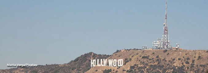
LAX FORECAST …
Air Quality Alert
AIR QUALITY ALERT FOR HARMFUL FINE PARTICLE POLLUTION LEVELS DUE TO WILDFIRE SMOKE until Tuesday evening for Santa Clarita Valley-Malibu Coast-Los Angeles County Beaches-Palos Verdes Hills-Los Angeles County Inland Coast including Downtown Los Angeles- Western Santa Monica Mountains Recreational Area- Eastern Santa Monica Mountains Recreational Area- Calabasas and Agoura Hills-Western San Fernando Valley- Eastern San Fernando Valley-Santa Susana Mountains- Interstate 5 Corridor- Western San Gabriel Mountains and Highway 14 Corridor- Eastern San Gabriel Mountains-Los Angeles County San Gabriel Valley- Including the cities of Lake Castaic, Newhall, Santa Clarita, Valencia, Malibu, Pacific Palisades, LAX, Long Beach, Redondo Beach, Santa Monica, Torrance, Rancho Palos Verdes, Beverly Hills, Compton, Culver City, Downey, Hollywood, Norwalk, Malibu Bowl, Topanga, Westlake Village, Malibu Lake, Northridge, Woodland Hills, Van Nuys, Chatsworth, Burbank, Universal City, Glendale, Sunland, La Canada Flintridge, Oat Mountain, Tejon Pass, Gorman, Pyramid Lake, Acton, Warm Springs, Mill Creek, Mount Wilson, Mount Baldy, Wrightwood, The Angeles Crest Highway, East Los Angeles, El Monte, Pasadena, Pomona, and San Gabriel
Monday Night: Mostly clear, with a low around 58. South wind 5 to 10 mph becoming east northeast after midnight.
Tuesday: Sunny, with a high near 75. Light and variable wind becoming west southwest 10 to 15 mph in the morning. Winds could gust as high as 20 mph.
Tuesday Night: Increasing clouds, with a low around 59. West wind 5 to 15 mph becoming east northeast after midnight. Winds could gust as high as 20 mph.
Wednesday: Patchy fog before 11am. Otherwise, cloudy through mid morning, then gradual clearing, with a high near 76. East wind 5 to 10 mph becoming west southwest 10 to 15 mph in the morning. Winds could gust as high as 20 mph.
Wednesday Night: Patchy fog. Otherwise, cloudy, with a low around 60. Southwest wind 5 to 10 mph becoming east southeast after midnight.
Thursday: Patchy fog before 11am. Otherwise, mostly sunny, with a high near 76.
Thursday Night: Mostly clear, with a low around 59.
Friday: Mostly sunny, with a high near 70.
Friday Night: Mostly clear, with a low around 57.
RADAR • Clouds • Temps • NWS Los Angeles • UV
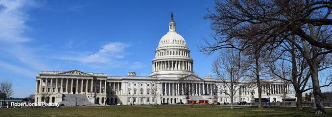
WASH DC FORECAST …
Overnight: Mostly clear, with a low around 72. South wind around 6 mph.
Tuesday: A slight chance of showers and thunderstorms after 2pm. Sunny and hot, with a high near 97. Southwest wind 5 to 9 mph. Chance of precipitation is 20%.
Tuesday Night: Partly cloudy, with a low around 74. Southwest wind around 8 mph.
Wednesday: Showers and possibly a thunderstorm after 2pm. High near 96. West wind 6 to 9 mph. Chance of precipitation is 80%. New rainfall amounts of less than a tenth of an inch, except higher amounts possible in thunderstorms.
Wednesday Night: Showers and possibly a thunderstorm before 2am, then showers likely. Low around 59. North wind 5 to 7 mph. Chance of precipitation is 80%.
Thursday: Showers likely, mainly before 2pm. Mostly cloudy, with a high near 69. Chance of precipitation is 60%.
Thursday Night: A chance of showers before 8pm, then a chance of showers after 2am. Mostly cloudy, with a low around 54. Chance of precipitation is 40%.
Friday: Showers likely, mainly after 8am. Mostly cloudy, with a high near 66. Chance of precipitation is 70%.
Friday Night: Showers. Low around 54. Chance of precipitation is 80%.
RADAR • Clouds • Temps • NWS Baltimore/Washington • UV
O’Hare Weather Forecast Compared to Phoenix, Miami, LA, Washington DC MON MAY 18, 2026 11:49 PM
