
CHICAGOLAND DETAILS …
Radar indicates precipitation the trailing edge of precipitation is moving east with rain ending in the northwest suburbs by 9:00 a.m.
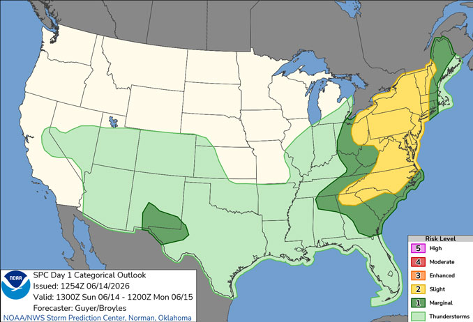
Scattered showers/isolated thunderstorms this morning then breezy and much cooler.
Dangerous swimming conditions at Indiana Lake Michigan beaches today and possibly again Thursday.
Shower and thunderstorm chances return Tuesday and Wednesday. There is the possibility for another severe weather event on Wednesday along with heavy rain/flooding.
See also: LIVE STREAMS: Arlingtoncardinal.com/StormChasers
O’HARE FORECAST …
Sunday: A 20 percent chance of showers before 10am. Partly sunny, with a high near 72. Breezy, with a northwest wind 15 to 20 mph, with gusts as high as 30 mph.
Sunday Night: Mostly clear, with a low around 54. Northwest wind 5 to 15 mph becoming west southwest after midnight.
Monday: Sunny, with a high near 76. West wind 5 to 15 mph.
Monday Night: Partly cloudy, with a low around 58. Southwest wind 5 to 10 mph, with gusts as high as 15 mph.
Tuesday: A chance of showers and thunderstorms, then showers and possibly a thunderstorm after 1pm. High near 77. Breezy, with a southwest wind 10 to 20 mph, with gusts as high as 30 mph. Chance of precipitation is 80%.
Tuesday Night: A slight chance of showers and thunderstorms before 10pm, then a slight chance of showers between 10pm and 1am. Partly cloudy, with a low around 56. Chance of precipitation is 20%.
Wednesday: A chance of showers, then showers and possibly a thunderstorm after 1pm. High near 77. Chance of precipitation is 80%.
Wednesday Night: Showers and possibly a thunderstorm before 1am, then a chance of showers. Mostly cloudy, with a low around 62.
Thursday: Partly sunny, with a high near 76.
Thursday Night: Partly cloudy, with a low around 58.
RADAR • Clouds • Temps • NWS CHGO • UV

PHOENIX FORECAST …
Sunday: Sunny, with a high near 109. Light southwest wind becoming west 5 to 10 mph in the afternoon.
Sunday Night: Clear, with a low around 85. West northwest wind 5 to 10 mph becoming south after midnight.
Monday: Sunny, with a high near 108. South wind 5 to 10 mph becoming west in the afternoon.
Monday Night: Mostly clear, with a low around 84. West wind around 5 mph.
Tuesday: Sunny, with a high near 109. West wind 5 to 10 mph.
Tuesday Night: Mostly clear, with a low around 84. Breezy, with a west southwest wind 5 to 15 mph, with gusts as high as 25 mph.
Wednesday: Sunny, with a high near 108. West southwest wind 5 to 10 mph, with gusts as high as 20 mph.
Wednesday Night: Mostly clear, with a low around 82. West southwest wind 5 to 10 mph, with gusts as high as 20 mph.
Thursday: Sunny, with a high near 106. Calm wind becoming west southwest around 5 mph in the afternoon.
Thursday Night: Clear, with a low around 80. West southwest wind 5 to 10 mph becoming light west after midnight.
RADAR • Clouds • Temps • NWS Phoenix • UV

MIAMI FORECAST …
Sunday: A 30 percent chance of showers and thunderstorms, mainly after 3pm. Mostly sunny, with a high near 91. Heat index values as high as 100. Calm wind becoming southeast 5 to 9 mph in the afternoon.
Sunday Night: A 30 percent chance of showers and thunderstorms, mainly before 8pm. Partly cloudy, with a low around 78. South wind around 6 mph becoming light and variable in the evening.
Monday: A 40 percent chance of showers and thunderstorms after 2pm. Mostly sunny, with a high near 91. Heat index values as high as 103. Calm wind becoming south 5 to 9 mph in the afternoon.
Monday Night: A 30 percent chance of showers and thunderstorms before 8pm. Partly cloudy, with a low around 78. Southwest wind 3 to 6 mph.
Tuesday: A 20 percent chance of showers and thunderstorms after 2pm. Sunny, with a high near 91. Light southwest wind becoming south 5 to 10 mph in the morning.
Tuesday Night: A 10 percent chance of showers and thunderstorms before 8pm. Mostly clear, with a low around 79. Southwest wind 3 to 7 mph.
Wednesday: Sunny, with a high near 92. Light south wind increasing to 5 to 10 mph in the morning.
Wednesday Night: Partly cloudy, with a low around 81. Southeast wind around 7 mph.
Thursday: Mostly sunny, with a high near 91. Southeast wind 6 to 10 mph.
Thursday Night: Partly cloudy, with a low around 81.
RADAR • Clouds • Temps • NWS Miami • UV

LAX FORECAST …
Beach Hazards Statement
Coastal Hazard Message
752 AM PDT Sun Jun 14 2026
BEACH HAZARDS STATEMENT REMAINS IN EFFECT THROUGH MONDAY EVENING in Ventura County Beaches, Malibu Coast, Los Angeles County Beaches, and Southern Santa Barbara County Beaches.
Dangerous rip currents and breaking waves due to elevated surf of 3 to 6 feet on south-facing beaches expected. In addition, high astronomical tides of 7.5 to 7.9 feet are expected each evening through Monday.
There is an increased risk of ocean drowning. Rip currents can pull swimmers and surfers out to sea. Waves can wash people off beaches and rocks, and capsize small boats nearshore. Minor coastal flooding are possible in low-lying areas near the times of high tides.
Sunday: Patchy fog before 11am. Otherwise, cloudy through mid morning, then gradual clearing, with a high near 73. West southwest wind 5 to 15 mph, with gusts as high as 20 mph.
Sunday Night: Patchy fog after 11pm. Otherwise, increasing clouds, with a low around 63. West southwest wind 10 to 15 mph decreasing to 5 to 10 mph after midnight. Winds could gust as high as 20 mph.
Monday: Patchy fog before 11am. Otherwise, cloudy through mid morning, then gradual clearing, with a high near 73. Light southwest wind becoming west southwest 10 to 15 mph in the afternoon. Winds could gust as high as 20 mph.
Monday Night: Patchy fog after 11pm. Otherwise, increasing clouds, with a low around 63. West southwest wind 10 to 15 mph decreasing to 5 to 10 mph after midnight. Winds could gust as high as 20 mph.
Tuesday: Patchy fog before 11am. Otherwise, mostly sunny, with a high near 72. Light west southwest wind increasing to 10 to 15 mph in the afternoon. Winds could gust as high as 20 mph.
Tuesday Night: Patchy fog after 11pm. Otherwise, mostly cloudy, with a low around 63.
Wednesday: Patchy fog before 11am. Otherwise, mostly sunny, with a high near 72.
Wednesday Night: Partly cloudy, with a low around 62.
Thursday: Partly sunny, with a high near 71.
Thursday Night: Partly cloudy, with a low around 61.
RADAR • Clouds • Temps • NWS Los Angeles • UV

WASH DC FORECAST …
Sunday: Scattered showers and thunderstorms after 5pm. Partly sunny, with a high near 95. South wind 10 to 14 mph, with gusts as high as 22 mph. Chance of precipitation is 30%.
Sunday Night: Showers and thunderstorms likely, mainly before 10pm. Mostly cloudy, with a low around 64. South wind 6 to 9 mph becoming northwest after midnight. Chance of precipitation is 70%. New rainfall amounts between a quarter and half of an inch possible.
Monday: Sunny, with a high near 79. Northwest wind around 14 mph, with gusts as high as 20 mph.
Monday Night: Partly cloudy, with a low around 60. Northwest wind 5 to 7 mph.
Tuesday: Mostly sunny, with a high near 81. Calm wind becoming south 5 to 7 mph in the afternoon.
Tuesday Night: A chance of showers and thunderstorms, mainly after 2am. Partly cloudy, with a low around 62. Chance of precipitation is 30%.
Wednesday: A chance of showers and thunderstorms before 8am. Mostly sunny, with a high near 86. Chance of precipitation is 30%.
Wednesday Night: Partly cloudy, with a low around 67.
Thursday: A slight chance of showers, then a chance of showers and thunderstorms after 2pm. Partly sunny, with a high near 95. Chance of precipitation is 30%.
Thursday Night: A chance of showers and thunderstorms. Mostly cloudy, with a low around 70. Chance of precipitation is 50%.
RADAR • Clouds • Temps • NWS Baltimore/Washington • UV
O’Hare Weather Forecast Compared to Phoenix, Miami, LA, Wash DC SUN JUN 14, 2026 9:33 AM SOURCE: National Weather Service local offices.
