
Sporadic wind damage throughout Chicagoland from Chicago’s Gold Coast to Aurora to Round Lake Beach was caused by non-thunderstorm wind gusts (Mugo Odigwe/Jermont Terry/CBS Chicago). YouTube Tips ⓘ
Numerous reports of tree limbs down and power outages were reported across northeast Illinois Tuesday night and overnight Tuesday to Wednesday. However, in Arlington Heights and many communities near Arlington Heights there were no thunderstorms or rain — just gusty winds. The advancing eastward thunderstorm line split to the north into Wisconsin, and south into central and southern Illinois. However, even without thunderstorms, there were non-thunderstorm gusts that caused sporadic damage across northern Illinois.
A large tree limb fell on the roof of a house in Round Lake Beach. Greater Round Lake Fire Protection District firefighters responded about 9:45 p.m. Tuesday night to the report of a large tree limb down on the roof of a house in the 100 block of Ferndale Drive in Round Lake Beach. The downed tree limb was greater than one foot in diameter.
In Arlington Heights, firefighters responded about 5:05 a.m. Wednesday, May 22, 2024 to a report a large tree limb on a house in the area of Haddow Avenue and Marshall Street. The tree on private property, split near the top. The tree limb diameter was about one foot. A private contractor removed the tree during the day on Wednesday.
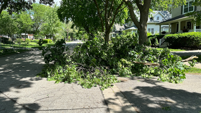
A large branch about six inches in diameter also fell on Haddow Avenue north of Miner Street, and was blocking the northbound lanes of Haddow Avenue in Arlington Heights. Numerous small branches were also scattered across many cities and villages in northern Illinois.
In Elgin and Chicago there were reports of tree limbs falling on parked vehicles.
Other Nearby Wind Damage Reports
Wires arcing in block of 1100 Perry Drive Palatine 9:18 AM
Tree on wires in block of 200 E Liberty Street Barrington 8:09 AM
Wires arcing in block of 26500 W Taylor Rd Barrington 7:27 AM
Branch on power line in block of 2200 Sunset Dr Inverness 7:09 AM
Tree on a power line in block of 900 W Kenilworth Ave Palatine 1:32 AM
Wire arcing in block of 100 Center Rd Streamwood 1:25 AM
Tree on power line in block of 500 Stuart Ln Palatine 12:07 AM
Tree on power line in block of 200 Elm St Palatine 11:56 PM
Tree fire in block of 100 S Maxon Ln Streamwood 9:52 PM
Transformer fire (loud explosion hear) in block of 1300 S Elmhurst Rd Mount Prospect (near KFC) 9:51 PM
Wire was on fire Chipping Campden Dr and Palatine Rd Barrington 9:49 PM
Wires arcing in block of 600 Malibou Ln Palatine 9:19 PM
Light post fire in block of 4300 Weber Dr Rolling Meadows 8:06 PM
Tree on wires in blovk of 200 Lincoln Terrace Buffalo Grove 8:00 PM
The National Weather Service indicated in the afternoon Tuesday, that tornado-producing storms were likely to weaken as they advanced from west to east across northern Illinois Tuesday afternoon and evening. However, a risk of winds up to around 75 MPH remained in the forecast. Also, the NOAA/NWS Storm Prediction Center indicated there was a 5% chance of tornadoes within 25 miles of zones in western and central areas of northern Illinois, and a 2% chance of tornadoes within 25 miles of zones in eastern and areas of northern Illinois. No tornadoes were reported in our area.
The nearest National Weather Service Tornado Watch was issued in McHenry County on Tuesday. The Tornado Watch was issued Tuesday, May 21, 2024 at 7:13PM CDT until May 22 at 12:00AM CDT.
The National Weather Service Tornado Watch included the following areas (nine counties) in Illinois: Boone, De Kalb, La Salle, Lee, Ogle, Winnebago, Kane, Kendall, McHenry. A sampling of included municipalities indicated at risk by the National Weather Service were Algonquin, Aurora, Belvidere, Byron, Crystal Lake, DeKalb, Dixon, Elgin, La Salle, Marseilles, McHenry, Mendota, Oregon, Oswego, Ottawa, Plano, Rochelle, Rockford, Streator, Sycamore, Woodstock, and Yorkville.
Also, a Wind Advisory was issued May 21, 2024 at 10:20PM CDT until May 22, 2024 at 2:00AM CDT by NWS Chicago. Southwest winds 20 to 30 mph with gusts to 50 mph were indicated as a risk overnight in portions of central, east central, north central and northeast Illinois and northwest Indiana. The NWS Chicago office forecast the possibility of gusty winds that could blow around unsecured objects, and tree limbs that could be blown down, and a few power outages.
NWS Chicago O’Hare reported the highest gust speed was 58 MPH (around midnight).
NWS Chicago Executive Airport reported the highest gust speed was 53 MPH (around 10 PM).
NWS Waukegan Airport reported the highest gust speed was 54 MPH (around around midnight).
A weather process known as Capping Inversion prevented the rising of thunderhead clouds near Arlington Heights. In an Inversion, cooler air gets below warmer air above. Inversion occurs when the normal temperature profile (warm air below, cold air above) is reversed, creating a stable configuration of dense, cold air sitting below lighter, warm air. Without warm air rising from the ground (usually heated by the sun), there is no convection, and there is no development of thunderstorms.
As an observer of Tuesday night’s weather conditions (before the storms were scheduled to hit), cool air was felt on the skin as if the storm line was directly overhead, but it wasn’t. Cooler air was felt at the surface by anyone who was outside before the line of storms approached our area, due to the inversion of cool air mixing and coming down to the surface. Anyone who pays attention to approaching storms could tell there was something that just wasn’t quite right — compared to other situations when thunderstorms are actually approaching. Eventually, there were no storms over Arlington Heights because there was a gap between the storm line in Wisconsin, and the storm line in central and southern Illinois.
The NWS described the condition as a stout capping inversion in the warm sector that had a weakening effect on convection and thunderstorm development. There were still some conditions that could have allowed convection and thunderstorms to rebound, so the NWS did not sound the all clear on the severe
threat Tuesday night.
^^ MOBILE? USE VOICE MIC ^^
facebook …
Please ‘LIKE’ the ‘Arlington Cardinal Page. See all of The Cardinal Facebook fan pages at Arlingtoncardinal.com/about/facebook …
Help fund The Cardinal Arlingtoncardinal.com/sponsor
THANKS FOR READING CARDINAL NEWS
