
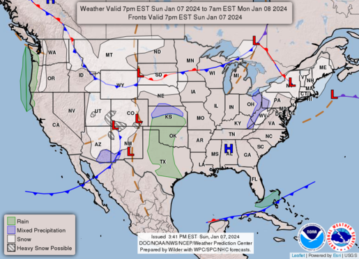
An intensifying upper trough over Arizona is forecasted to continue amplifying as it makes its way over the southern Rockies Sunday evening and into late Sunday night. A 90-100 kt 500 mb jet will emerge over the southern Plains around midnight CST, helping to rapidly deepen a surface low over northeast New Mexico and the northwestern Texas and Oklahoma Panhandles.
Strong low-level warm advection ahead of the surface low will aid in developing low-topped thunderstorms across West Texas and into parts of far southwest OK between 8-12z. Likely elevated above the surface stable layer, and with limited buoyancy owing to poor boundary-layer dewpoints in the 30-40s F, storms are not expected to be overly intense. However, very strong low and mid-level wind fields ahead of the trough/low my support the risk for occasional gusty/damaging winds with the line of storms. Will maintain the MRGL risk across west-central Texaswith a slight northward nudge into southwest OK for the latest CAM guidance.
