
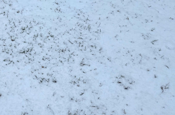
Roads are slippery, but the outlook for this afternoon is that this snow event has lost the punch it was expected to produce. The precipitation image on radar had passed more than half of its size over Arlington Heights by 1:00 p.m., and appeared to be contracting, while only an 0.5 inch of snow accumulation had appeared on paved surfaces and less than 1 inch on grass lawns.
UPDATE: Almost 2 inches on grass, almost 1 inch on concrete driveway, slush accumulation on streets at 3:20 p.m.
With a late arrival of snow compared to the forecast, and above-freezing temperatures with drizzle expected after the snow ends, Arlington Heights and many communities in northeast Illinois will likely experience far less snow than had been forecasted early this morning. The actual snow accumulation is more likely to align better with the forecast from about 48 hours ago.
At 9:40 a.m. the NWS Office Chicago reported regional radar imagery depicted an expansive precipitation shield from central Iowa eastward through central Ohio with a variety of precipitation types ranging from freezing rain to snow to “plain” rain. Precipitation — arriving late — was just starting to reach the ground across northern Illinois with reports of snow in Joliet, Peru, La Salle, Dixon, and Morris. Indeed, the stout low-level dry layer seen nicely in AMDAR soundings is saturating and cooling right on time, according to NWS Chicago. Snow was expected to become increasingly steady and spread northward over the coming morning and early afternoon hours, with the peak coverage and intensity between roughly noon and 3 pm. Based on upstream observations and incoming 12Z model guidance, pockets of 1″/hr snow rates appeared increasingly likely which “will all but certain lead to slushy accumulations on roadways,” according to NWS Chicago. The NWS Chicago office said the steadiest snow and accumulations “remain likely north of I-80 with lesser amounts to the south owing to an eventual switch over to a cold rain.” The NWS Chicago Office at 9:40 a.m. reported that “total amounts of 1-3″ appear all but certain, with locally higher amounts of 2-4″ along the Wisconsin state line.”
Snow and rain was expected to taper from south to north pretty quickly this evening giving way to drizzle and fog. Temperatures should also rise above freezing once the heaviest precipitation rates end, helping start to melt the snow, said NWS Chicago. However, it appears the south to north taper is occurring much earlier than expected.
Nevertheless, at 12:10 PM CST, Chicago O’hare picked up the first 0.1″ of an inch of snow this season; therefore the date of December 28, 2021 now stands as the latest date for the first measurable snow in Chicago on record… 287 days after the last measurable snowfall that occurred on March 15, 2021.
Weather Radar shows precipitation over northeast Illinois, southeast Wisconsin, northwest Indiana and southwest Michigan. The image is contracting and the trailing edge mark the end of heavy snowfall in Arlington Heights before 2:00 p.m.
See also Arlingtoncardinal.com/clouds
Moderate to heavy snowfall continues this afternoon. Heaviest snowfall amounts will continue through 3 PM this afternoon with snow gradually ending through mid-evening. Be cautious on the roads and be sure to increase distance between you and other vehicles. #ilwx #INwx pic.twitter.com/iK4DDpsXoc
— NWS Chicago (@NWSChicago) December 28, 2021
We're heading into the period of steadiest snow across our area. Webcams across the area show snow sticking to roads and low visibility, such as near Mendota, Rockford, Lowell (IN). Take it slow on ice and snow!! #ilwx #inwx. pic.twitter.com/E2brXMIElO
— NWS Chicago (@NWSChicago) December 28, 2021
And they are off! Snow resources are now deployed to streets across the City to manage today's snowfall. Chicago motorists, please take care and drive safely. pic.twitter.com/Joixr5AobG
— Chicago Department of Streets and Sanitation (@StreetsandSan) December 28, 2021
O’HARE FORECAST …
This Afternoon: Snow before 4pm, then rain, possibly mixed with snow. The snow could be heavy at times. Areas of fog after 2pm. Steady temperature around 33. East wind 10 to 15 mph, with gusts as high as 25 mph. Chance of precipitation is 100%. Total daytime snow accumulation of 2 to 4 inches possible.
Tonight: A 50 percent chance of rain, mainly before 10pm. Areas of fog. Otherwise, cloudy, with a steady temperature around 35. East wind 5 to 10 mph becoming west after midnight.
Wednesday: A slight chance of rain and snow between 3pm and 4pm, then a slight chance of snow after 4pm. Mostly cloudy, with a high near 35. West northwest wind 5 to 10 mph. Chance of precipitation is 20%.
Wednesday Night: Snow likely, mainly before midnight. Cloudy, with a low around 29. North northeast wind around 5 mph, with gusts as high as 15 mph. Chance of precipitation is 70%. New snow accumulation of around an inch possible.
LAKE TEMPS …
SOUTHERN LAKE MICHIGAN WATER TEMPERATURES
NATIONAL WEATHER SERVICE CHICAGO/ROMEOVILLE IL
943 AM CST Tue Dec 28 2021
LAKE MICHIGAN WATER TEMPERATURES…
CHICAGO SHORE……….45.
CHICAGO CRIB……….43.
MICHIGAN CITY……….41.
&&
M IS FOR MISSING DATA THAT IS NORMALLY AVAILABLE.
THE MICHIGAN CITY WATER TEMPERATURE SENSOR IS LOCATED AT A WATER
INTAKE ONE MILE OFFSHORE AND 60 FEET BELOW WATER SURFACE. IT IS READ
EVERY DAY OF THE YEAR.
december.chicagoweatherstation.com
Chicago Weather Forecast for your MAC/PC/TABLET includes surrounding suburbs.
^^ MOBILE? USE VOICE MIC ^^
facebook …
Please ‘LIKE’ the ‘Arlington Cardinal Page. See all of The Cardinal Facebook fan pages at Arlingtoncardinal.com/about/facebook …
Help fund The Cardinal Arlingtoncardinal.com/sponsor
20240105-1435future
