Archive | October 22nd, 2007


Break-in at Bang and Olufsen

A break-in was reported Monday night at Bang & Olufsen in the 700 block of West Dundee Road near Dundee and Kennicott.

Bang & Olufsen (B&O) is a Danish company that designs and manufactures high end audio products, television sets, and telephones.

Posted in 24/7 Crime Alerts!, CRIME BLOGComments Off

It’s In God’s Hands Now, They Pray the Wind Will Die Down


View north-northwest from Vista, California toward Camp Pendleton Marine Corps Base showing smoke in the distance from the Rice Fire near Fallbrook about 15 miles north [MAP/SAT] blowing smoke across Camp Pendleton. Some smoke may also be visible from the Santiago Canyon Fire further north beyond Camp Pendleton.

Except for the northern horizon, residents of Vista, California experienced a beautiful, but dry day, with Santa Ana winds and fears that they could be called to evacuate with the start of a new fire.

Santa Ana winds are warm, dry winds that blow northeast to southwest and characteristically appear in Southern California and Northern Baja California weather during autumn and early winter.

Santa Ana winds are a type of f

Posted in Fire VideoComments Off

Celebrities Among Hundreds of Thousands Evacuated

Among the hundreds of thousands of people affected by evacuation or damage to property, the following celebrities have been reported to have been affected by the fires:

James Cameron
Courtney Cox
David Duchovny — refused to evacuate
Olivia Newton John
Sean Penn
Suzanne Somers — threatened again, she already lost one home in Malibu in January 2007.

Governor Arnold Schwarzenegger ordered the California National Guard to make 1,500 guardsmen available to support firefighting efforts throughout Southern California.

Among structures destroyed? The Malibu Presbyterian Church and the residential home called the Kashan Castle, also known as Hodge Castle, a 10,500-square-foot hilltop landmark built in 1978. The castle had been listed for sale since March for $17 million. Firefighters retrieved and saved many historical relics from inside the Kashan Castle.

Posted in Fire VideoComments Off

Map of Southern California October 2007 Fires

NOVEMBER 2008 FIRE MAPS — CLICK HERE …


View Larger Map referenced  from the Los Angeles Times

Map of Southern California October 2007 fires (referenced Los Angeles Times) includes the following data subject to change without update on this posting. The following list is a snapshot of data from a Google map with a reference to the Los Angeles Times updated Monday, October 22, 2007 3:51 CDT (view map and balloon popups for latest information):

Canyon Fire (Malibu) 11:40 a.m. updated, 10-22)
Acres burned: 2,400 Destroyed: 5 homes, 2 commercial and business buildings, church. Containment: 10% People evacuated: 1,500 Damaged: 5 businesses, 9 homes damaged. Point of origin: Malibu Canyon Roa…
Acres burned: 2,400
Destroyed: 5 homes, 2 commercial and business buildings, church.
Containment: 10%
People evacuated: 1,500
Damaged: 5 businesses, 9 homes damaged.
Point of origin: Malibu Canyon Road at Piuma Road
Burned toward Pacific and Pepperdine University, then moved southeast.
Direction burning: Southeast
Threatened: 600 homes, 200 commercial, 100 outbuildings.
Firefighters dispatched: 1,500 firefighters
Injuries to residents: none
Injuries to firefighters: none
Time of start: 4:50 a.m., 10-21
Possible cause: Downed power lines

Buckweed Fire (Agua Dulce) 1p.m. updated 10-22
Acres burned: 27,500 Destroyed: 25 structures destroyed; 3,800 structures threatened Injuries to residents: 3 burned Injuries to firefighters: 1 injured Most Recent Location: Mint Canyon at Mint Canyo…
Acres burned: 27,500
Destroyed: 25 structures destroyed; 3,800 structures threatened
Injuries to residents: 3 burned
Injuries to firefighters: 1 injured
Most Recent Location: Mint Canyon at Mint Canyon Road and Sierra Highway, Fire burning toward Magic Mtn
Containment: 20%
Location: Agua Dulce, Canyon Country, Santa Clarita, Leona Valley, Green Valley, Acton, and Mint Canyon threatened
Point of origin: 11727 W. Mint Canyon Road
Homes Evacuated: 5,500 (15,000 people evacuated)
Direction burning: southwest
Firefighters dispatched: 685
Time of start: 12:55 p.m. Sunday
Note: 60-65 mph wind gusts expected today.

Witch Fire (NE S.D. Co.) 11:40 a.m. Updated 10-22
Acres burned: 10,000 and growing Damage: “Several structures” damaged/destroyed. Threatened: 2,000 homes, 400 commercial properties, 50 outbuildings. Evacuations: Community of Ramona Point of Origin: …
Acres burned: 10,000 and growing
Damage: “Several structures” damaged/destroyed.
Threatened: 2,000 homes, 400 commercial properties, 50 outbuildings.
Evacuations: Community of Ramona
Point of Origin: Witch Creek area near Santa Ysabel, northeast San Diego County, 60 miles from downtown San Diego
Direction burning: Witch Creek fire burning east toward Julian and west toward Ramona.
Firefighters dispatched: 369
Injuries to residents: none reported
Injuries to firefighters: none reported
Cause: N/A
Time start: 11 a.m. (10-21)

Harris Fire (SE S.D. Co) 1:30 pm. 10-22 Updated
Acres burned: 20,000 Containment: 5% Damage: at least one building Injuries to residents: at least one dead; 20 civilians injured: Four firefighters suffered non-life-threatening burns and were being …
Acres burned: 20,000
Containment: 5%
Damage: at least one building
Injuries to residents: at least one dead; 20 civilians injured: Four firefighters suffered non-life-threatening burns and were being taken to UC San Diego Medical Center burn center.
Location: southeast San Diego County, 75 miles east of downtown San Diego, near international border
Point of origin: near Potrero

Direction burning: Burning on both sides of Highway 94 near Harris Ranch Road in Potrero.
Firefighters dispatched: 275

Time of start: 9:30 a.m. (10-21)
Possible cause: N/A

Ranch Fire (Castaic) 11:40 a.m. updated 10-22
Acres burned: 29,000 acres Containment: 10% Damage: Shed destroyed; as many as 150 homes are in fire’s path Location: Burning 6 miles north of Castaic; evacuations in Hasley Canyon, Oak Springs, Val V…
Acres burned: 29,000 acres
Containment: 10%
Damage: Shed destroyed; as many as 150 homes are in fire’s path
Location: Burning 6 miles north of Castaic; evacuations in Hasley Canyon, Oak Springs, Val Verde and Piru.
Point of origin: due west of the Templin Highway and I-5 junction, near Townsend Peak
Home evacuated: 1,000
Direction burning: southwest
Firefighters: 653
Injuries to residents: none reported
Injuries to firefighters: none reported
Time of start: 9:42 p.m. Saturday

ass="onelinei">Night Sky Fire/Santa Rosa Valley (7 pm updated 10-21) (Ventura County, between Moorpark and Thousand Oaks)
Acres burned: 35 Location: Ventura County, between Moorpark and Thousand Oaks Point of origin: 13545 Night Sky Drive, Lexington, south of Moorpark and north of Thousand Oaks Direction burning: east, t…
Acres burned: 35
Location: Ventura County, between Moorpark and Thousand Oaks
Point of origin: 13545 Night Sky Drive, Lexington, south of Moorpark and north of Thousand Oaks
Direction burning: east, toward Santa Rosa Valley
Firefighters dispatched: about 100 in 22 engines; three hand crews, one water tanker and three helicopters
Damage: 250 structures threatened
Injuries to residents: none reported
Injuries to firefighters: none reported
Time of start: reported at 10:35 a.m.
Possible cause: N/A; fire began in brush behind homes
Note: Fire not contained at 7 p.m. 10-21, but about evacuation order of 200 homes in Lexington area has been lifted.

Sedgwick Fire (11:40 a.m. updated) (Los Olivos, Santa Barbara County)
Acres burned: 710 Containment: 50% Location: Los Olivos area, Santa Barbara County; burning in Brinkerhoff Road, Sedgewick Road, Figueroa Mountain Area. Threatened: 450 homes and one outbuilding in Wo…
Acres burned: 710
Containment: 50%
Location: Los Olivos area, Santa Barbara County; burning in Brinkerhoff Road, Sedgewick Road, Figueroa Mountain Area.
Threatened: 450 homes and one outbuilding in Woodstock and Brinkerhoff Road areas
Firefighters dispatched: About 400
Point of origin: Began in brush about five miles north of Los Olivos, at Highway 154 and Highway 246
Time of start: reported at 6 a.m., 10-21
Injuries to residents: none reported
Injuries to firefighters: none reported
Cause: sparking from downed power lines
Notes: Officials issued evacuation warning for about 2,000 residents of the Woodstock area.

Bear Fire (7:30 p.m. update 10-21)
Acres burned: 1.5 Location: Southwest of Lake Arrowhead Point of origin: near Highway 18 and Bear Springs Road Direction burning: N/A Firefighters: 22 Damage: no homes threatened Injuries to residents…
Acres burned: 1.5
Location: Southwest of Lake Arrowhead
Point of origin: near Highway 18 and Bear Springs Road
Direction burning: N/A
Firefighters: 22
Damage: no homes threatened
Injuries to residents: none reported
Injuries to firefighters: none reported
Time of start: reported at 4:18 p.m.
Possible cause: N/A

Roca Fire (Aguanga, Riv Co.) 11:40 a.m. updated
Acres burned: 269 Containment: 60%. Destroyed: One home Injured: One resident injured for unrelated abdominal pain Time of start: 3:52 p.m., 10-21 Location: Aguanga, Riverside County Roca Vista Road a…
Acres burned: 269
Containment: 60%.
Destroyed: One home
Injured: One resident injured for unrelated abdominal pain
Time of start: 3:52 p.m., 10-21
Location: Aguanga, Riverside County
Roca Vista Road at Highway 371
Threatened: 300 residences in or near Aguanga, Jojoba Hills resort, Crosley Homestead, Agua Tibea Wilderness and the Cleveland National Forest. Jojoba Hills resorts and Rancho California RV park under mandatory evacuation.
Firefighters dispatched: 300
Cause: Unknown

Santiago Canyon Fire (O.C.) 11:40 a.m. 10-22 updated
Acres burned: 8,800 Containment: 30% Damage: One home destroyed, two homes damaged. Injuries: One firefighter injured Location: Silverado Point of origin: Silverado Canyon and Santiago Canyon roads, b…
Acres burned: 8,800
Containment: 30%
Damage: One home destroyed, two homes damaged.
Injuries: One firefighter injured
Location: Silverado
Point of origin: Silverado Canyon and Santiago Canyon roads, but crossed Hwy. 241 to the west, and burning to the edge toward the Portola Springs and Northwood village of Irvine.
Firefighters on scene: 500
Time of start: 5:55 p.m. 10-21.
Believed cause: arson.
Note: mandatory evacuations lifted this morning.

Ontario Fire (9:20 p.m.) 10-21
4 acre brush fire in South Ontario

Guejito Fire (northern San Diego) 9 a.m. Updated 10-22
Acres burned: Unknown Damage: Moving into residential areas Location: Currently at Rancho Bernardo, a neighborhood in the northern part of San Diego Point of origin: near Santa Ysabel Time of start: 1…
Acres burned: Unknown
Damage: Moving into residential areas
Location: Currently at Rancho Bernardo, a neighborhood in the northern part of San Diego
Point of origin: near Santa Ysabel

Time of start: 10-21 afternoon
Possible cause: under investigation

Grass Valley Fire (N. Lake Arrowhead) Updated 1:45 p.m. 10-22
Acres burned: 200 Started: 5:08 a.m. 10-22 Destroyed: 100 structures Threatened: 1,500 homes; town of Lake Arrowhead and adjacent towns Injuries: None. Evacuations: Deer Lodge Park Location: Grass Val…
Acres burned: 200
Started: 5:08 a.m. 10-22
Destroyed: 100 structures
Threatened: 1,500 homes; town of Lake Arrowhead and adjacent towns
Injuries: None.
Eva
cuations: Deer Lodge Park
Location: Grass Valley Creek and North Lake Arrowhead.
Origin: Grass Valley Creek
Cause: Under investigation.
Containment: N/A
Evacuations: mandatory North Lake Arrowhead, voluntary Cedar Glen, Twin Peaks, Rim Forest.
Direction: north
Firefighters: Number N/A
Time of start: 12 a.m. 10-22
Slide Fire (Lake Arrowhead) 12:25 p.m. 10-22
Acres: 200 acres Damaged: 15 homes destroyed; homes being lost in Green Valley Lake Started: 8:02 a.m. in Grass Valley Creek Cause: Under Investigation Containment: N/A Located: East of Green Valley L…
Acres: 200 acres
Damaged: 15 homes destroyed; homes being lost in Green Valley Lake
Started: 8:02 a.m. in Grass Valley Creek

Cause: Under Investigation
Containment: N/A
Located: East of Green Valley Lake, north of Forest Road 2N-13.
Evacuated: Green Valley Lake, Arrowbear, Running Springs.
Direction: southwest
Winds: 30 mph from the northeast

Coronado Hills Fire (11:40 a.m. 10-22 updated)
Acres burned: 300 Containment: 0% People evacuated: Damage: None reported Direction burning: Burning south of Cal State San Marcos, communities of Discovery Hill, Coronado Hill, and San Elijo Hill thr…
Acres burned: 300
Containment: 0%
People evacuated:
Damage: None reported
Direction burning: Burning south of Cal State San Marcos, communities of Discovery Hill, Coronado Hill, and San Elijo Hill threatened. Evacuations in progress.
Firefighters dispatched:
Injuries to residents:
Injuries to firefighters:
Time of start: 1:46 p.m. 10-21
Possible cause:

McCoy Fire (S.D. Co.) 11:40 a.m. updated
Acres burned: 400 Destroyed: One home Containment: 5% People evacuated: Damaged: Point of origin: Direction burning: Burning in Boulder Creek/Eagle Peak area of S.D. County Threatened: . Firefighters …
Acres burned: 400
Destroyed: One home
Containment: 5%
People evacuated:
Damaged:
Point of origin:
Direction burning: Burning in Boulder Creek/Eagle Peak area of S.D. County
Threatened: .
Firefighters dispatched:
Injuries to residents:
Injuries to firefighters:
Time of start:
Possible cause:
Rice Fire 11:40 a.m. updated
Acres burned: 50 Damage: One structure damaged. Containment: Unknown People evacuated: Evacuations in progress Damaged: Point of origin: Direction burning: Threatened: Firefighters dispatched: Injurie…
Acres burned: 50
Damage: One structure damaged.
Containment: Unknown
People evacuated: Evacuations in progress
Damaged:
Point of origin:
Direction burning:
Threatened:
Firefighters dispatched:
Injuries to residents:
Injuries to firefighters:
Time of start: 4:16 a.m. on 10-22
Possible cause:
Cajon Fire (12:59 p.m.)
Fire reported at I-15 and I-215 split. Acres


MORE INFORMATION:
Los Angeles Times (latimes.com)

Posted in Fire VideoComments Off

San Diego Wildfire VIDEO


Video showing reduced visibility from smoke and falling ash.

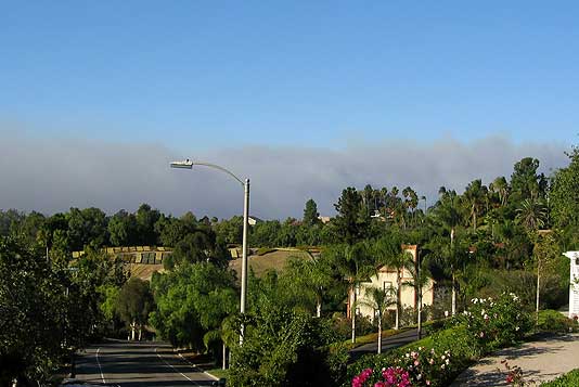
Local freeways are closed, I-15 between CA-78 and SR-56, HWY 67 N/b, CA-78 Eastbound, I-8 eastbound, and many other freeways going east are closed.

36,000 people  evacuated and 5,000 acres burned in Ramona, California. Ramona is located in North San Diego Country [MAP/SAT].

17 people burned, including 4 firefighters with serious injuries.

Overall 250,000 people will be forced to evacuate their homes on Monday, October 21, 2007. The fire is expected to reach the San Diego city limits Monday as seven counties in Southern California are in a state of emergency. Qualcomm stadium has been opened to evacuees.

All fires included in Los Angeles and San Diego area, there are almost 100,000 acres destroyed by fire as of about lunch time Monday in California.


Video showing loss of visibility in the hills and valleys of San Diego County.

San Diego Fire News Feed …

Posted in Fire VideoComments Off

Santa Clarita, California Wildfire VIDEO


Video of Santa Clarita Valley wildfire on Sunday, October 21, 2007.

High gusts with Santa Ana winds fanned two fires on Santa Clarita’s outer limits. By 2 p.m., the sky turned orange as dense clouds of smoke fell over the Santa Clarita Valley northeast of Simi Valley and northwest of San Fernando and Hollywood [MAP/SAT].

Santa Clarita, California weather  Sunday, October 21, 2007
from Weather Underground.

Posted in Fire VideoComments Off

 
THE CARDINAL Arlington Heights Chicago Newsbattery status Cardinal Calendar Search Batteries PlusTHE CARDINAL Arlington Heights Chicago News
CLICK CALENDAR TO SEARCH ARTICLES BY DATE

Loading...


Fitness Tips Health News

Exercise Reports
EXERCISE-REPORTS.COM (main)
exercisereports.com (journal)

Exercise, Sports Medicine
Nutrition News & Journal
Nutrition Data & Analysis
FITNESSMATH.COM calculator
Anatomy/Physiology reference

Fitness is a luxury in prosperous times. Fitness is a necessity in tough times. Strength, stamina, injury prevention and disease prevention are priorities, especially in tough times when lowered health care costs and productivity are important.
Don't Let the News Wear You Down!
Affirmations and Adapatation are key to success!

1. Exercise everyday. 2. Lift weights 3-5 days per week. 3. Get cardiovascular exercise 3-5 days per week. 4. Walk every day. 5. Learn posture and anatomy and optimal body mechanics for safety and injury prevention. 6. Drink plenty of water. 7. Learn nutrition and healthy eating. 8. Learn your optimal consumption of macronutrients (carbohydrates, protein and fat) and consume accordingly. 9. Get enough rest and sleep. 10. Be intelligent: Learn and adapt to the changing world.

Sports medicine, medical news, fitness news & more ...
Exercisereports.com for Health & Fitness News ...


COOLFITNESSGIFTS.COM FITNESS/SPORTS
Baseball products -- baseballs, pitching machines, batting batting gloves, baseball mitts, baseball helmets, baseball bats ...
Basketball products -- backboards, basketballs, basketball nets, chain nets, basketball hoop lights ...
SPRI Products -- exercise tubing, SPRI Xertube, SPRI Travel Kits, SPRI Wall Charts, SPRI Xerball Medicine Balls ...
BOSU -- BOSU, the blue half-ball that's great for balance ...
Physioballs and Swiss Balls ...
Sports Bras -- Calvin Klein bras, DKNY bras, Maidenform bras, Under Armour sports bras...
Under Armour -- UA Heat Gear, UA Cold Gear, Under Armour Shirts, Under Armour Shorts
Resistance Weights -- Dumbbells, Hex Dumbbells, Vinyl Dumbbells, Power Blocks, PlateMate ...

Sports medicine, medical news, fitness news & more ...
Exercisereports.com Health & Fitness News ...

 
Cool Fitness Gifts


Streets of Arlington Heights
STREETSOFARLINGTON.COM
MAPS FOR ARLINGTON HEIGHTS ...


POPULAR LINKS

AHS Film Documentary ...
The Arlington High School Film Documentary "The Lady in Red"


Arlington Heights American Legion Post 208 Baseball at Recreation Park
Lloyd W. Meyer Field -- Arlingtoncards.com/post208


Arlington Heights Restaurants

Arlington Heights Fast Food
Arlington Heights Pizza
Arlington Heights Sushi
Arlington Heights Bars

Arlington Heights Weather

Arlington Heights Health & Fitness
Arlington Heights Hair Salons
Arlington Heights Commute
Arlington Heights Real Estate
Arlington Heights Hotels
Arlington Heights Gardening

Arlingtoncards.com Site Map


Buffalo Grove High School
Football Schedule


Hersey High School Football Schedule


Prospect High School Basketball Schedule


St. Viator High School Football Schedule


FESTIVAL 2010
Arlington Heights Frontier Days

Chicago-Shops.com: Map of Shopping Malls Near Chicago | Chicago Area Airports and Airport Maps

Arlington Heights Blog
© Copyright 2006-2010 Apriori, Inc.
Arlingtoncards.com, THE CARDINAL, Arlingtoncardinal.net, DIGITAL LIFESTYLE, and digital-lifestyle.com are copyright of Apriori, Inc. AA-ER.COM. Life, Liberty, and the pursuit of happiness

  Apple iTunes   Apple iTunes
spacer
 

Cool Fitness Gifts

Great Fitness Gifts on CoolFitnessGifts.com
AIDS/HIV Awareness/Condoms

Sports Bras
| SPRI Products
SPRI Tubing
| Anatomy Models
Baseball Products | Basketball ProductsBOSU
Dumbbells | iPods | Total Gym


CHICAGOFANFARE.COM
Chicago Cubs Caps | Chicago Cubs Merchandise


iTunes HITS FOR LAST MONTH

iTunes Store: Top Songs in March 2009