
TOTAL LUNAR ECLIPSE overnight with totality at 2:06 a.m.
Tetrad: First of Four Consecutive Total Lunar Eclipses Begins Midnight April 14/15 (Tuesday/Wednesday)
 Total Lunar Eclipse with air temperature forecast 29 degrees at 2:06 a.m.
Chicagoland weather radar [LIVE PRECIPITATION TYPE RADAR] shows rain passing Chicagoland from southwest to northeast. The northern edge of precipitation is located along a line from Schaumburg to southern Arlington Heights to Highland Park. Some snow is indicated on the northern edge of precipitation.
Satellite images show clouds over much of northern Illinois. Clouds are expected to decrease after 10:00 p.m., which could be in time to see the the total lunar eclipse beginning about 11:53 p.m. CDT Monday and reaches totality at 2:06 a.m. CDT Tuesday.
From spring back to winter, at least for the next 48 hrs! Rain to snow during afternoon commute in Chicago. Light http://t.co/q9LXbP5wEK
— NWS Chicago (@NWSChicago) April 14, 2014
NWS Chicago outlook.
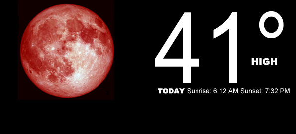
TODAY Sunrise: 6:12 AM Sunset: 7:32 PM
Snow likely, possibly mixed with rain, mainly after 5pm. Cloudy, with a high near 41. Breezy, with a north wind 15 to 25 mph, with gusts as high as 30 mph diminishing to about 15 mph at 6:00 a.m. Chance of precipitation is 60%. Total daytime snow accumulation of less than a half inch possible, most likely to occur between 1:00 p.m. and 7:00 p.m.
Tonight TOTAL LUNAR ECLIPSE at 2:06 a.m. begins at 11:53 a.m. with an air temperature of about 29 degrees at 2:06 a.m. Snow likely, mainly before 8pm. Cloudy, then gradually becoming partly cloudy after 10:00 p.m, with a low around 24 at 6:00 a.m. to 7:00 a.m.. North wind 10 to 15 mph, with gusts as high as 25 mph. Chance of precipitation is 60%. New snow accumulation of less than a half inch possible.
Tuesday Mostly sunny, with a high near 42 at about 4:00 p.m.. North northwest wind 5 to 10 mph, with gusts as high as 15 mph from 9:00 a.m. to 1:00 p.m.
Tuesday Night Partly cloudy, with a low around 29. Calm wind becoming southeast around 5 mph after midnight. Winds could gust as high as 10 mph.
Wednesday Partly sunny, with a high near 52. Breezy, with a south wind 10 to 15 mph increasing to 20 to 25 mph in the afternoon. Winds could gust as high as 35 mph.
Wednesday Night Mostly cloudy, with a low around 40. Breezy.
Thursday Partly sunny, with a high near 59.
Thursday Night A slight chance of rain. Mostly cloudy, with a low around 42.
Friday A chance of rain. Mostly cloudy, with a high near 54.
Friday Night A chance of rain. Mostly cloudy, with a low around 40.
Saturday A chance of rain. Partly sunny, with a high near 53.
Saturday Night A slight chance of rain. Mostly cloudy, with a low around 40.
Sunday A chance of rain. Mostly cloudy, with a high near 59.
LIVE RADAR | STORM TRACKS | UNISYS US IR SAT | UNISYS Midwest IR SAT | UNISYS More IR SAT
WunderMap® with Temperature/Wind Data || Google: Arlington Heights Temps | NE Illinois Temps
Full Screen Motion Weather Radar (Wunderground.com)
Midwest Cloud Cover with Arlington Heights Weather Forecast
ChicagoWeatherStation.com I O’Hare Normal Temps/Precip I O’Hare Record Temps, Precip, Snow
SUNLIGHT DATA FOR SECURITY, TRAFFIC SAFETY, AND SPORTS
SunCalc.net data with solar azimuth and trajectory, times for dawn, sunrise, solar noon, sunset, dusk …
Become a fan of The Cardinal weather page. Submit your pictures or just stay up-to-date on weather topics — go direct to the Arlington Cardinal Weather photos. For a list of all of The Cardinal Facebook fan pages, go to Arlingtoncardinal.com/about/facebook …
