


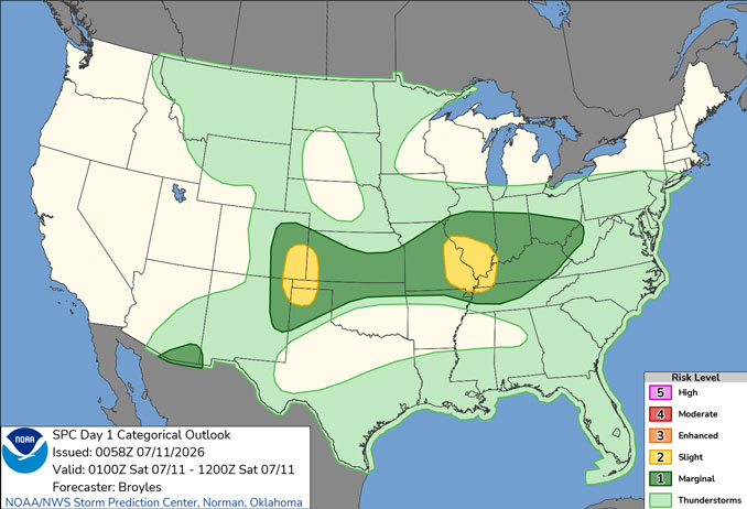
CHICAGOLAND DETAILS …
Radar is clear in northern Illinois.
See also: LIVE STREAMS: Arlingtoncardinal.com/StormChasers
Temperature Outlook …
SA 66 84 | SU 67 87 | M 69 90 | T 71 92
O’HARE FORECAST …
Friday Night: Mostly cloudy, with a low around 66. North northeast wind 5 to 10 mph, with gusts as high as 15 mph.
Saturday: Mostly sunny, with a high near 84. Northeast wind 5 to 10 mph, with gusts as high as 15 mph.
Saturday Night: Partly cloudy, with a low around 67. Northeast wind 5 to 10 mph.
Sunday: Sunny, with a high near 87. East wind 5 to 10 mph.
Sunday Night: Mostly clear, with a low around 69. East northeast wind 5 to 10 mph becoming light east in the evening.
Monday: Sunny, with a high near 90.
Monday Night: Clear, with a low around 71.
Tuesday: Sunny, with a high near 92.
Tuesday Night: Mostly clear, with a low around 75.
Wednesday: Sunny, with a high near 92.
Wednesday Night: Mostly clear, with a low around 72.
Thursday: Mostly sunny, with a high near 89.
Thursday Night: Partly cloudy, with a low around 71.
RADAR • Clouds • Temps • NWS CHGO • UV

PHOENIX FORECAST …
Extreme Heat Warning until July 10, 08:00 PM MST
Air Quality Alert
Relayed by National Weather Service Phoenix AZ
921 AM MST Fri Jul 10 2026
…PM-10 HIGH POLLUTION ADVISORY FOR MARICOPA COUNTY INCLUDING THE PHOENIX METRO AREA FRIDAY…
The Arizona Department of Environmental Quality (ADEQ) has issued a PM-10 High Pollution Advisory for the Phoenix Metro Area on Friday.
An episode of strong and gusty winds is forecast to generate widespread blowing dust that may result in local PM-10 concentrations that pose a health risk. Adverse health effects increase as air quality deteriorates.
Coarse particulate matter – also known as PM-10 – is an air contaminant that can aggravate heart and lung disease conditions, especially in older adults, children, and those with asthma. A decrease in physical activity is recommended.
Consolidate your travel, stabilize loose soils, slow down or avoid travel on dirt roads, reduce or eliminate fireplace use, and avoid using gas-powered lawn equipment.
For details on this High Pollution Advisory, visit the ADEQ internet site at www.azdeq.gov/forecast/phoenix or call 602-771-2300.
Friday Night: Mostly clear, with a low around 87. West wind 5 to 10 mph becoming northeast after midnight. Winds could gust as high as 25 mph.
Saturday: Sunny, with a high near 108. West wind 5 to 10 mph.
Saturday Night: Partly cloudy, with a low around 88. Breezy, with a southwest wind 10 to 15 mph becoming west northwest 5 to 10 mph after midnight. Winds could gust as high as 25 mph.
Sunday: Mostly cloudy, then gradually becoming sunny, with a high near 108. Heat index values as high as 111. West wind around 5 mph.
Sunday Night: A chance of showers and thunderstorms. Mostly cloudy, with a low around 85. South wind around 5 mph becoming calm after midnight. Chance of precipitation is 40%.
Monday: Mostly sunny, with a high near 107. Calm wind becoming south southwest around 5 mph in the afternoon.
Monday Night: A 40 percent chance of showers and thunderstorms, mainly before 11pm. Mostly cloudy, with a low around 87. South southwest wind around 5 mph becoming calm in the evening.
Tuesday: A 20 percent chance of showers and thunderstorms. Mostly sunny, with a high near 108. Calm wind becoming south southwest around 5 mph in the afternoon.
Tuesday Night: A 30 percent chance of showers and thunderstorms, mainly before 11pm. Partly cloudy, with a low around 87. South wind around 5 mph becoming calm.
Wednesday: A slight chance of showers, then a chance of showers and thunderstorms after 11am. Mostly sunny, with a high near 108. East southeast wind around 5 mph. Chance of precipitation is 30%.
Wednesday Night: A 40 percent chance of showers and thunderstorms. Mostly cloudy, with a low around 86. East wind around 5 mph.
Thursday: A 30 percent chance of showers and thunderstorms. Mostly sunny, with a high near 104. East southeast wind around 5 mph becoming south in the afternoon.
Thursday Night: A 50 percent chance of showers and thunderstorms. Mostly cloudy, with a low around 84. South wind around 5 mph becoming east southeast after midnight. New rainfall amounts of less than a tenth of an inch, except higher amounts possible in thunderstorms.
RADAR • Clouds • Temps • NWS Phoenix • UV

MIAMI FORECAST …
Friday Night: A 30 percent chance of showers and thunderstorms, mainly between 2am and 3am. Partly cloudy, with a low around 81. Southeast wind 7 to 9 mph.
Saturday: A chance of showers and thunderstorms before 1pm, then a slight chance of showers and thunderstorms after 2pm. Mostly sunny, with a high near 92. Heat index values as high as 109. Southeast wind 7 to 9 mph. Chance of precipitation is 30%.
Saturday Night: Partly cloudy, with a low around 82. East wind 5 to 7 mph.
Sunday: A 20 percent chance of showers and thunderstorms after 2pm. Mostly sunny, with a high near 93. Heat index values as high as 108. East wind 3 to 8 mph.
Sunday Night: A 10 percent chance of showers and thunderstorms before 8pm. Mostly clear, with a low around 81. Southeast wind 3 to 7 mph.
Monday: A 20 percent chance of showers and thunderstorms after 2pm. Sunny, with a high near 93. Light southeast wind increasing to 5 to 9 mph in the afternoon.
Monday Night: A 10 percent chance of showers and thunderstorms before 8pm. Mostly clear, with a low around 81. Southeast wind 3 to 7 mph.
Tuesday: Sunny, with a high near 93. Light southeast wind becoming east 5 to 9 mph in the afternoon.
Tuesday Night: Mostly clear, with a low around 81. Southeast wind 5 to 7 mph.
Wednesday: A 20 percent chance of showers and thunderstorms after 2pm. Mostly sunny, with a high near 93.
Wednesday Night: A 10 percent chance of showers and thunderstorms. Partly cloudy, with a low around 81.
Thursday: A 20 percent chance of showers and thunderstorms. Sunny, with a high near 93.
Thursday Night: A 10 percent chance of showers and thunderstorms. Partly cloudy, with a low around 81.
RADAR • Clouds • Temps • NWS Miami • UV
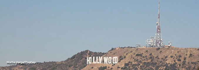
LAX FORECAST …
Extreme Heat Watch in effect from July 14, 10:00 AM PDT until July 16, 08:00 PM PDT
Beach Hazards Statement in effect from July 12, 11:00 AM PDT until July 15, 05:00 PM PDT
Friday Night: Mostly cloudy, with a low around 66. Southwest wind 5 to 10 mph, with gusts as high as 15 mph.
Saturday: Patchy fog before 11am. Otherwise, mostly cloudy, with a high near 79. Southwest wind 5 to 10 mph, with gusts as high as 15 mph.
Saturday Night: Patchy fog after 11pm. Otherwise, cloudy, with a low around 66. Southwest wind 5 to 10 mph becoming light in the evening. Winds could gust as high as 15 mph.
Sunday: Cloudy, then gradually becoming mostly sunny, with a high near 76. Light south southwest wind becoming southwest 5 to 10 mph in the afternoon. Winds could gust as high as 15 mph.
Sunday Night: Mostly cloudy, with a low around 66. West southwest wind 5 to 10 mph becoming light southwest in the evening.
Monday: Patchy fog after 11am. Otherwise, mostly cloudy, with a high near 77.
Monday Night: Partly cloudy, with a low around 67.
Tuesday: Mostly sunny, with a high near 77.
Tuesday Night: Mostly clear, with a low around 69.
Wednesday: Mostly sunny, with a high near 81.
Wednesday Night: Partly cloudy, with a low around 71.
Thursday: Mostly sunny, with a high near 81.
Thursday Night: Partly cloudy, with a low around 70.
RADAR • Clouds • Temps • NWS Los Angeles • UV
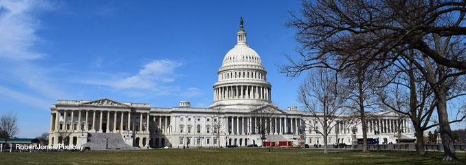
WASH DC FORECAST …
Friday Night: Mostly cloudy, with a low around 73. Calm wind.
Saturday: A chance of showers and thunderstorms, mainly after 2pm. Mostly cloudy, with a high near 86. Calm wind becoming north around 6 mph in the afternoon. Chance of precipitation is 40%.
Saturday Night: A chance of showers and thunderstorms before 11pm, then a slight chance of showers between 11pm and midnight. Mostly cloudy, with a low around 69. Calm wind. Chance of precipitation is 30%.
Sunday: Partly sunny, with a high near 85. East wind 3 to 7 mph.
Sunday Night: Mostly cloudy, with a low around 67. Southeast wind around 5 mph becoming calm in the evening.
Monday: Mostly sunny, with a high near 85.
Monday Night: Mostly clear, with a low around 66.
Tuesday: Sunny, with a high near 91.
Tuesday Night: Clear, with a low around 72.
Wednesday: Sunny and hot, with a high near 98.
Wednesday Night: Mostly clear, with a low around 76.
Thursday: Sunny, with a high near 95.
Thursday Night: Partly cloudy, with a low around 75.
Baltimore/Washington DC Forecast
RADAR • Clouds • Temps • NWS Baltimore/Washington • UV
O’Hare Weather Forecast Compared to Phoenix, Miami, LA, Wash DC FRI JUL 10, 2026 8:13 PM SOURCE: National Weather Service local offices.
