


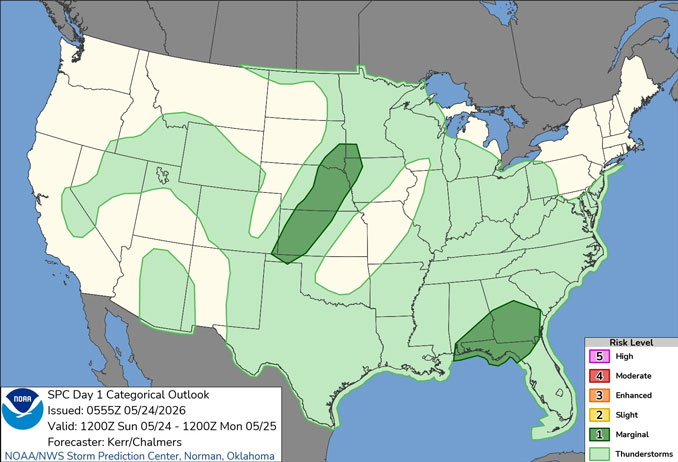
CHICAGOLAND DETAILS …
Higher coverage of showers and storms is expected early this morning through midday, particularly near and east of I-55, with a threat of locally heavy rainfall which may lead to ponding in poor drainage areas.
Above normal temperatures are expected through early next week, though cooler conditions will occur near Lake Michigan each day.
O’HARE FORECAST …
Overnight Saturday/Sunday: A 40 percent chance of showers and thunderstorms. Cloudy, with a steady temperature around 58 about 5am to 6am Sunday. Southeast wind around 5 mph becoming calm.
Sunday: Showers and possibly a thunderstorm between 5am and 9am, then a lesser chance of showers and thunderstorms between 9am and 11am. High near 79 about 4pm to 5pm. West northwest wind 5 to 10 mph becoming north northeast in the afternoon. Chance of precipitation is 80%. New precipitation amounts between a tenth and quarter of an inch, except higher amounts possible in thunderstorms.
Sunday Night: Mostly clear, with a low around 59. East wind around 5 mph becoming calm in the evening.
Memorial Day Monday: Sunny, with a high near 85. South wind 5 to 10 mph.
Monday Night: Mostly clear, with a low around 64. South wind 5 to 10 mph.
Tuesday: Mostly sunny, with a high near 86.
Tuesday Night: A 20 percent chance of showers after 1am. Mostly cloudy, with a low around 67.
Wednesday: Partly sunny, with a high near 81.
Wednesday Night: Mostly cloudy, with a low around 61.
See also: LIVE STREAMS: Arlingtoncardinal.com/StormChasers
O’HARE FORECAST …
Overnight Saturday/Sunday: A 40 percent chance of showers and thunderstorms. Cloudy, with a steady temperature around 58. Southeast wind around 5 mph becoming calm.
Sunday: Showers and possibly a thunderstorm before 9am, then a chance of showers and thunderstorms between 9am and 11am. High near 79. West northwest wind 5 to 10 mph becoming north northeast in the afternoon. Chance of precipitation is 80%. New precipitation amounts between a tenth and quarter of an inch, except higher amounts possible in thunderstorms.
Sunday Night: Mostly clear, with a low around 59. East wind around 5 mph becoming calm in the evening.
Memorial Day Monday: Sunny, with a high near 85. South wind 5 to 10 mph.
Monday Night: Mostly clear, with a low around 64. South wind 5 to 10 mph.
Tuesday: Mostly sunny, with a high near 86.
Tuesday Night: A 20 percent chance of showers after 1am. Mostly cloudy, with a low around 67.
Wednesday: Partly sunny, with a high near 81.
Wednesday Night: Mostly cloudy, with a low around 61.
RADAR • Clouds • Temps • NWS CHGO • UV

PHOENIX FORECAST …
Overnight Saturday/Sunday: Clear, with a low around 72. Calm wind.
Sunday: Sunny, with a high near 99. Calm wind becoming south southwest around 5 mph in the afternoon.
Sunday Night: Mostly clear, with a low around 75. West wind 5 to 10 mph becoming southeast after midnight. Winds could gust as high as 20 mph.
Memorial Day: Sunny, with a high near 97. Calm wind becoming west southwest around 5 mph in the afternoon.
Monday Night: Mostly clear, with a low around 72. West wind around 5 mph becoming calm after midnight.
Tuesday: Sunny, with a high near 97. Calm wind becoming southwest around 5 mph in the afternoon.
Tuesday Night: Clear, with a low around 71. West southwest wind 5 to 10 mph becoming light and variable after midnight.
Wednesday: Sunny, with a high near 96. Breezy, with a light south southeast wind becoming southwest 10 to 15 mph in the morning. Winds could gust as high as 25 mph.
Wednesday Night: Clear, with a low around 68. Breezy, with a southwest wind 10 to 15 mph becoming light and variable after midnight. Winds could gust as high as 25 mph.
RADAR • Clouds • Temps • NWS Phoenix • UV

MIAMI FORECAST …
Rip Current Statement
Overnight Saturday/Sunday: A slight chance of showers and thunderstorms between 11pm and 2am. Mostly cloudy, with a low around 80. East wind around 10 mph. Chance of precipitation is 20%.
Sunday: Mostly sunny, with a high near 88. Southeast wind 9 to 14 mph, with gusts as high as 21 mph.
Sunday Night: A chance of showers and thunderstorms before 1am, then a slight chance of showers between 1am and 2am. Partly cloudy, with a low around 79. East wind around 11 mph, with gusts as high as 21 mph. Chance of precipitation is 30%.
Memorial Day Monday: Mostly sunny, with a high near 88. East wind 13 to 15 mph, with gusts as high as 23 mph.
Monday Night: A slight chance of showers and thunderstorms before 11pm, then a slight chance of showers between 11pm and 2am. Partly cloudy, with a low around 80. East wind around 11 mph, with gusts as high as 21 mph. Chance of precipitation is 20%.
Tuesday: A slight chance of showers between 8am and 11am, then a slight chance of showers and thunderstorms after 11am. Mostly sunny, with a high near 88. Southeast wind 13 to 15 mph, with gusts as high as 23 mph. Chance of precipitation is 20%.
Tuesday Night: A chance of showers and thunderstorms before 11pm, then a chance of showers between 11pm and 2am, then a chance of showers and thunderstorms after 2am. Mostly cloudy, with a low around 80. Southeast wind around 10 mph, with gusts as high as 18 mph. Chance of precipitation is 40%.
Wednesday: A chance of showers and thunderstorms, then showers likely and possibly a thunderstorm after 2pm. Mostly cloudy, with a high near 87. Southeast wind 11 to 14 mph, with gusts as high as 20 mph. Chance of precipitation is 60%.
Wednesday Night: Showers likely and possibly a thunderstorm before 8pm, then a chance of showers and thunderstorms between 8pm and 2am, then showers likely and possibly a thunderstorm after 2am. Mostly cloudy, with a low around 79. Southeast wind around 9 mph. Chance of precipitation is 60%.
RADAR • Clouds • Temps • NWS Miami • UV
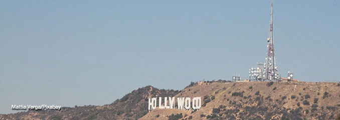
LAX FORECAST …
Overnight Saturday/Sunday: Patchy fog. Otherwise, cloudy, with a low around 58. West southwest wind around 5 mph.
Sunday: Patchy fog before 11am. Otherwise, cloudy, then gradually becoming mostly sunny, with a high near 68. West southwest wind 5 to 10 mph increasing to 10 to 15 mph in the afternoon. Winds could gust as high as 20 mph.
Sunday Night: Patchy fog. Otherwise, cloudy, with a low around 57. West southwest wind 5 to 15 mph, with gusts as high as 20 mph.
Memorial Day Monday: Patchy fog before 11am. Otherwise, cloudy through mid morning, then gradual clearing, with a high near 67. West southwest wind 5 to 10 mph increasing to 10 to 15 mph in the afternoon. Winds could gust as high as 20 mph.
Monday Night: Patchy fog. Otherwise, cloudy, with a low around 57. West southwest wind 10 to 15 mph decreasing to 5 to 10 mph after midnight. Winds could gust as high as 20 mph.
Tuesday: Patchy fog before 11am. Otherwise, partly sunny, with a high near 66.
Tuesday Night: Patchy fog after 11pm. Otherwise, mostly cloudy, with a low around 57.
Wednesday: Patchy fog before 11am. Otherwise, partly sunny, with a high near 67.
Wednesday Night: Partly cloudy, with a low around 56.
RADAR • Clouds • Temps • NWS Los Angeles • UV
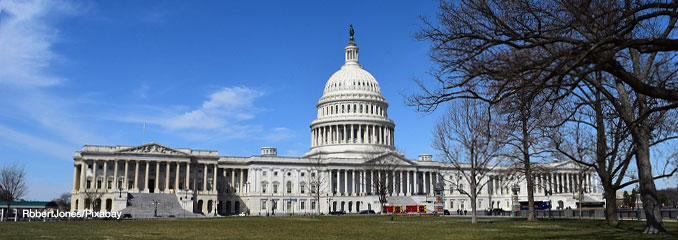
WASH DC FORECAST …
Overnight Saturday/Sunday: Showers and possibly a thunderstorm. Patchy fog. Low around 54. Light northeast wind. Chance of precipitation is 90%. New rainfall amounts between a tenth and quarter of an inch, except higher amounts possible in thunderstorms.
Sunday: Showers and thunderstorms likely before 9am, then a chance of showers. Patchy fog before 10am. Otherwise, cloudy, with a high near 70. Light northeast wind. Chance of precipitation is 60%. New precipitation amounts between a tenth and quarter of an inch, except higher amounts possible in thunderstorms.
Sunday Night: A chance of showers and thunderstorms, then showers likely after 2am. Patchy fog after midnight. Otherwise, cloudy, with a low around 63. Light east wind. Chance of precipitation is 70%. New rainfall amounts of less than a tenth of an inch, except higher amounts possible in thunderstorms.
Memorial Day Monday: A chance of showers, with thunderstorms also possible after 2pm. Mostly cloudy, with a high near 78. Southwest wind 3 to 5 mph. Chance of precipitation is 50%.
Monday Night: Showers likely and possibly a thunderstorm. Mostly cloudy, with a low around 63. Calm wind. Chance of precipitation is 70%.
Tuesday: Showers likely, mainly before 2pm. Mostly cloudy, with a high near 79. Chance of precipitation is 70%.
Tuesday Night: A chance of showers. Mostly cloudy, with a low around 64. Chance of precipitation is 40%.
Wednesday: A chance of showers, then showers likely and possibly a thunderstorm after 2pm. Mostly cloudy, with a high near 82. Chance of precipitation is 60%.
Wednesday Night: Showers likely and possibly a thunderstorm before 8pm, then a chance of showers between 8pm and 2am. Mostly cloudy, with a low around 65. Chance of precipitation is 60%.
RADAR • Clouds • Temps • NWS Baltimore/Washington • UV
O’Hare Weather Forecast Compared to Phoenix, Miami, LA, Washington DC SUN MAY 24, 2026 3:55 AM
