


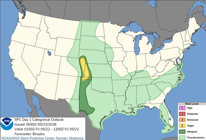
CHICAGOLAND DETAILS …
Expect plenty of dry hours through Memorial Day Weekend. Isolated to widely scattered thunderstorms are possible late Saturday night into Sunday, with storm potentially primarily southeast of I-55 Sunday afternoon.
Below average temperatures to close out the work week will trend to near to above average into next week, though notably cooler conditions will prevail near Lake Michigan.
See also: LIVE STREAMS: Arlingtoncardinal.com/StormChasers
ARL HTS FORECAST …
Beach Hazards Statement
Coastal Hazard Message
938 PM CDT Thu May 21 2026
BEACH HAZARDS STATEMENT REMAINS IN EFFECT THROUGH SATURDAY AFTERNOON in counties Lake IL-Northern Cook-Central Cook-
Overnight Thursday/Friday: Mostly cloudy, with a low around 49 about 3am to 7am Friday. East northeast wind around 10 mph.
Friday: Mostly cloudy, with a high near 65. East northeast wind around 15 mph picking up around 8am, with gusts as high as 25 mph peaking about 3pm to 4pm.
Friday Night: A 20 percent chance of showers after 11pm. Cloudy, with a low around 52 around 6am Saturday. East northeast wind 10 to 15 mph, with gusts as high as 20 mph.
Saturday: A 20 percent chance of showers before 1pm. Mostly cloudy, with a high near 70 about 4pm to 5pm. North northeast wind 5 to 10 mph.
Saturday Night: A 20 percent chance of showers after 1am. Mostly cloudy, with a low around 53. Northeast wind around 5 mph becoming calm in the evening.
Sunday: A chance of showers and thunderstorms before 4pm, then a slight chance of showers. Mostly cloudy, with a high near 77. Chance of precipitation is 30%.
Sunday Night: Mostly cloudy, with a low around 56.
Memorial Day (Monday): Mostly sunny, with a high near 83.
Monday Night: Partly cloudy, with a low around 59.
RADAR • Clouds • Temps • NWS CHGO • UV

PHOENIX FORECAST …
Overnight Thursday/Friday: Clear, with a low around 69. Calm wind becoming northwest around 5 mph.
Friday: Sunny, with a high near 96. Calm wind becoming southwest around 5 mph in the afternoon.
Friday Night: Mostly clear, with a low around 70. West wind 5 to 10 mph becoming light and variable after midnight.
Saturday: Sunny, with a high near 97. Calm wind becoming west around 5 mph in the afternoon.
Saturday Night: Clear, with a low around 72. West wind 5 to 10 mph becoming light and variable after midnight.
Sunday: Sunny, with a high near 99. Calm wind becoming west around 5 mph in the afternoon.
Sunday Night: Clear, with a low around 74. West wind around 5 mph becoming calm after midnight.
Memorial Day Monday: Sunny, with a high near 97. Calm wind becoming west around 5 mph in the afternoon.
Monday Night: Mostly clear, with a low around 71. West wind around 5 mph becoming calm after midnight.
RADAR • Clouds • Temps • NWS Phoenix • UV

MIAMI FORECAST …
Rip Current Statement
Coastal Hazard Message
729 PM EDT Thu May 21 2026
HIGH RIP CURRENT RISK NOW IN EFFECT THROUGH TUESDAY EVENING for Coastal Broward County-Coastal Miami Dade County
Overnight: Partly cloudy, with a low around 79. Southeast wind around 9 mph.
Friday: Partly sunny, with a high near 88. East wind 8 to 11 mph.
Friday Night: Partly cloudy, with a low around 80. East wind 8 to 10 mph.
Saturday: A slight chance of showers between 10am and 11am, then a slight chance of showers and thunderstorms after 11am. Mostly sunny, with a high near 88. East wind 8 to 11 mph. Chance of precipitation is 20%.
Saturday Night: A chance of showers and thunderstorms before 2am, then a slight chance of showers. Partly cloudy, with a low around 80. East wind around 10 mph. Chance of precipitation is 30%.
Sunday: A slight chance of showers before 8am, then a slight chance of showers and thunderstorms after 2pm. Mostly sunny, with a high near 88. East wind 10 to 14 mph, with gusts as high as 21 mph. Chance of precipitation is 20%.
Sunday Night: A slight chance of showers and thunderstorms before 11pm, then a slight chance of showers between 11pm and 2am, then a slight chance of showers and thunderstorms after 2am. Partly cloudy, with a low around 81. East wind around 11 mph, with gusts as high as 21 mph. Chance of precipitation is 20%.
Memorial Day Monday: A 20 percent chance of showers and thunderstorms. Mostly sunny, with a high near 88. East wind 13 to 15 mph, with gusts as high as 23 mph.
Monday Night: A 30 percent chance of showers and thunderstorms. Partly cloudy, with a low around 81. East wind around 14 mph, with gusts as high as 22 mph.
RADAR • Clouds • Temps • NWS Miami • UV
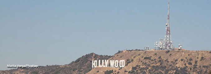
LAX FORECAST …
Overnight Thursday/Friday: Patchy fog. Otherwise, cloudy, with a low around 59. South southeast wind around 5 mph.
Friday: Patchy fog before 11am. Otherwise, cloudy through mid morning, then gradual clearing, with a high near 68. South southeast wind 5 to 15 mph becoming west southwest in the afternoon.
Friday Night: Patchy fog. Otherwise, cloudy, with a low around 58. Southwest wind 5 to 15 mph.
Saturday: Patchy fog before 11am. Otherwise, cloudy through mid morning, then gradual clearing, with a high near 67. Light west southwest wind increasing to 10 to 15 mph in the afternoon. Winds could gust as high as 20 mph.
Saturday Night: Patchy fog. Otherwise, cloudy, with a low around 58. West southwest wind 5 to 15 mph, with gusts as high as 20 mph.
Sunday: Patchy fog before 11am. Otherwise, mostly sunny, with a high near 66.
Sunday Night: Patchy fog. Otherwise, cloudy, with a low around 57.
Memorial Day Monday: Patchy fog before 11am. Otherwise, mostly sunny, with a high near 65.
Monday Night: Partly cloudy, with a low around 56.
RADAR • Clouds • Temps • NWS Los Angeles • UV
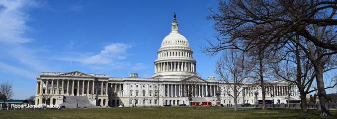
WASH DC FORECAST …
Overnight Thursday/Friday: Showers. Low around 55. Northeast wind around 7 mph. Chance of precipitation is 80%. New precipitation amounts of less than a tenth of an inch possible.
Friday: Showers. High near 62. Northeast wind 7 to 10 mph, with gusts as high as 20 mph. Chance of precipitation is 100%. New precipitation amounts between a tenth and quarter of an inch possible.
Friday Night: Showers. Low around 50. East wind around 8 mph. Chance of precipitation is 90%. New precipitation amounts between a quarter and half of an inch possible.
Saturday: Showers and thunderstorms likely, then showers and possibly a thunderstorm after 8am. High near 62. East wind around 11 mph, with gusts as high as 21 mph. Chance of precipitation is 100%. New rainfall amounts between a half and three quarters of an inch possible.
Saturday Night: Showers and possibly a thunderstorm. Low around 55. Northeast wind 5 to 9 mph. Chance of precipitation is 90%.
Sunday: A chance of showers and thunderstorms before 11am, then a chance of showers between 11am and 2pm, then a slight chance of showers and thunderstorms after 2pm. Mostly cloudy, with a high near 74. Chance of precipitation is 50%.
Sunday Night: A chance of showers after 8pm. Mostly cloudy, with a low around 61. Chance of precipitation is 40%.
Memorial Day Monday: A chance of showers, then showers likely and possibly a thunderstorm after 2pm. Mostly cloudy, with a high near 79. Chance of precipitation is 70%.
Monday Night: Showers likely and possibly a thunderstorm before 8pm, then a chance of showers. Mostly cloudy, with a low around 62. Chance of precipitation is 60%.
RADAR • Clouds • Temps • NWS Baltimore/Washington • UV
O’Hare Weather Forecast Compared to Phoenix, Miami, LA, Washington DC FRI MAY 22, 2026 0:22 AM
