


CHICAGOLAND DETAILS …
Radar for northern Illinois indicates precipitation as diminishing scattered showers as expected this morning. Radar echoes are diminishing to nothing by about the Fox River.
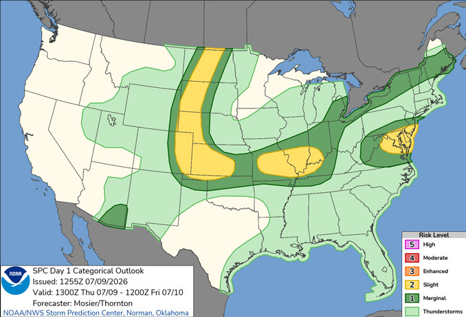
Scattered thunderstorms are expected at times through this evening. These storms will be capable of locally heavy rainfall which may lead to flooding, particularly if they stall or redevelop over areas hardest hit from last weekend.
Scattered showers could occur anytime Thursday, but the greatest chance for thundershowers is after 3 PM until about midnight Thursday/Friday.
The strongest storms will also be capable of gusty to locally damaging wind gusts this afternoon and evening with the greatest threat south of I-80.
Mainly dry and warmer weather is expected this weekend into early next week.
See also: LIVE STREAMS: Arlingtoncardinal.com/StormChasers
Temperature Outlook …
F 67 80 | SA 66 83 | SU 68 86 | M 70 88
O’HARE FORECAST …
Thursday: Isolated showers, then scattered showers and thunderstorms after 10am. Mostly cloudy, with a high near 83. West southwest wind 5 to 10 mph. Chance of precipitation is 30%.
Thursday Night: Scattered showers and thunderstorms, mainly before midnight. Patchy fog after 1am. Otherwise, mostly cloudy, with a low around 67. West northwest wind 5 to 10 mph becoming east northeast in the evening. Chance of precipitation is 50%.
Friday: Areas of fog before 9am. Otherwise, mostly cloudy, with a high near 80. Northeast wind 5 to 10 mph.
Friday Night: Mostly cloudy, with a low around 66. North wind 5 to 10 mph.
Saturday: Mostly sunny, with a high near 83. Northeast wind 5 to 10 mph.
Saturday Night: Partly cloudy, with a low around 68.
Sunday: Sunny, with a high near 86.
Sunday Night: Mostly clear, with a low around 70.
Monday: Sunny, with a high near 88.
Monday Night: Mostly clear, with a low around 73.
Tuesday: Sunny, with a high near 90.
Tuesday Night: Mostly clear, with a low around 74.
RADAR • Clouds • Temps • NWS CHGO • UV
O’Hare Weather Forecast THU JUL 09, 2026 9:29 AM SOURCE: National Weather Service local offices.
