


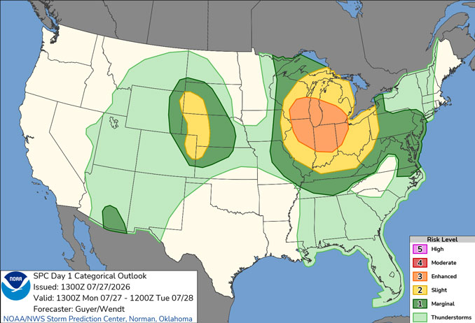
CHICAGOLAND DETAILS …
Radar indicates precipitation as showers and thunderstorms developing as a straight band from western suburbs up into Wisconsin. The band of storms is forecast to reach Arlington Heights about 11:10 a.m. This will likely be a quick, intense band of storms, that will be over quickly. Additional storm development is likely Monday through 9PM with the severest weather about 7PM to 9PM.
Thunderstorms possible through early this evening, any storms that occur could be severe with damaging winds and potentially some large hail.
Heat and absolutely stifling humidity will result in dangerous heat indices outside of any storms today.
Dangerous swimming conditions due to large waves and strong currents are expected late tonight through early Wednesday morning.
The Air Quality Index is 65, and the AQI has been in the Moderate (Yellow) category since July 24, 2026.
See also: LIVE STREAMS: Arlingtoncardinal.com/StormChasers
Temperature Outlook …
T 70 78 | W 65 81 | R 66 85 | F 70 83
O’HARE FORECAST …
Heat Advisory until July 27, 09:00 PM CDT
Beach Hazards Statement in effect from July 28, 03:00 AM CDT until July 29, 10:00 AM CDT
Monday: A 20 percent chance of showers and thunderstorms after 11am. Mostly cloudy, with a high near 91. Heat index values as high as 106. Southwest wind 10 to 15 mph, with gusts as high as 30 mph.
Monday Night: A 30 percent chance of showers and thunderstorms, mainly before 9pm. Mostly cloudy, with a low around 70. West southwest wind 10 to 15 mph becoming north after midnight. Winds could gust as high as 25 mph.
Tuesday: Mostly sunny, with a high near 78. North northeast wind around 15 mph, with gusts as high as 25 mph.
Tuesday Night: Mostly clear, with a low around 65. North wind 5 to 15 mph.
Wednesday: Sunny, with a high near 81. North northeast wind 5 to 10 mph.
Wednesday Night: Mostly clear, with a low around 66.
Thursday: Sunny, with a high near 85.
Thursday Night: Partly cloudy, with a low around 70.
Friday: A chance of showers, with thunderstorms also possible after 1pm. Mostly cloudy, with a high near 83.
Friday Night: A chance of showers and thunderstorms. Mostly cloudy, with a low around 68.
Saturday: A chance of showers and thunderstorms. Partly sunny, with a high near 81.
Saturday Night: Partly cloudy, with a low around 67.
RADAR • Clouds • Temps • NWS CHGO • UV

PHOENIX FORECAST …
Extreme Heat Warning
Monday: Sunny and hot, with a high near 110. Heat index values as high as 113. West wind 5 to 10 mph.
Monday Night: A 10 percent chance of showers and thunderstorms after 5am. Partly cloudy, with a low around 90. West wind 5 to 10 mph becoming south southwest after midnight.
Tuesday: A 10 percent chance of showers and thunderstorms before 8am. Mostly sunny, with a high near 109. Heat index values as high as 112. West wind 5 to 10 mph.
Tuesday Night: Partly cloudy, with a low around 90. West wind 5 to 10 mph.
Wednesday: Sunny and hot, with a high near 111. Calm wind becoming west around 5 mph in the afternoon.
Wednesday Night: Mostly clear, with a low around 91. West wind around 5 mph.
Thursday: Mostly sunny and hot, with a high near 113. Light west southwest wind becoming west 5 to 10 mph in the afternoon.
Thursday Night: Mostly clear, with a low around 92. West wind around 5 mph.
Friday: Mostly sunny and hot, with a high near 115. Light west southwest wind becoming west 5 to 10 mph in the afternoon.
Friday Night: Partly cloudy, with a low around 92. West southwest wind 5 to 10 mph.
Saturday: Mostly sunny and hot, with a high near 114. West southwest wind around 5 mph.
Saturday Night: Partly cloudy, with a low around 92. West southwest wind around 5 mph.
RADAR • Clouds • Temps • NWS Phoenix • UV

MIAMI FORECAST …
Monday: Showers and thunderstorms, mainly before 4pm. Some of the storms could produce heavy rainfall. High near 90. Heat index values as high as 105. West wind 5 to 8 mph becoming south in the afternoon. Chance of precipitation is 80%. New rainfall amounts between a quarter and half of an inch possible.
Monday Night: A 10 percent chance of showers and thunderstorms before 8pm. Partly cloudy, with a low around 78. West wind 5 to 7 mph.
Tuesday: A chance of showers and thunderstorms before 1pm, then a chance of showers and thunderstorms after 2pm. Mostly sunny, with a high near 91. Heat index values as high as 106. Southwest wind 5 to 11 mph, with gusts as high as 18 mph. Chance of precipitation is 50%. New rainfall amounts of less than a tenth of an inch, except higher amounts possible in thunderstorms.
Tuesday Night: Partly cloudy, with a low around 79. Southwest wind 6 to 9 mph.
Wednesday: Mostly sunny, with a high near 93. Southwest wind 7 to 14 mph, with gusts as high as 21 mph.
Wednesday Night: Partly cloudy, with a low around 79. Southwest wind 6 to 11 mph, with gusts as high as 18 mph.
Thursday: Mostly sunny, with a high near 93. Southwest wind 6 to 13 mph, with gusts as high as 20 mph.
Thursday Night: Partly cloudy, with a low around 80. West wind 6 to 10 mph.
Friday: A 30 percent chance of showers and thunderstorms after 2pm. Mostly sunny, with a high near 93. Light southwest wind becoming south 6 to 11 mph in the morning.
Friday Night: A 30 percent chance of showers and thunderstorms before 8pm. Mostly cloudy, with a low around 80.
Saturday: A 30 percent chance of showers and thunderstorms. Mostly sunny, with a high near 92.
Saturday Night: A 30 percent chance of showers and thunderstorms. Partly cloudy, with a low around 81.
RADAR • Clouds • Temps • NWS Miami • UV
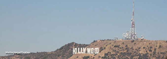
LAX FORECAST …
Heat Advisory
Beach Hazards Statement
Monday: Sunny, with a high near 81. West southwest wind 5 to 10 mph, with gusts as high as 15 mph.
Monday Night: Partly cloudy, with a low around 68. West southwest wind 5 to 10 mph becoming south southeast after midnight.
Tuesday: Mostly sunny, with a high near 80. South southeast wind 5 to 15 mph becoming west southwest in the afternoon.
Tuesday Night: Partly cloudy, with a low around 67. West southwest wind 5 to 10 mph becoming southeast after midnight.
Wednesday: Mostly sunny, with a high near 80. East southeast wind 5 to 10 mph becoming southwest in the afternoon.
Wednesday Night: Partly cloudy, with a low around 67.
Thursday: Mostly sunny, with a high near 80.
Thursday Night: Partly cloudy, with a low around 69.
Friday: Sunny, with a high near 88.
Friday Night: Mostly clear, with a low around 70.
Saturday: Mostly sunny, with a high near 88.
Saturday Night: Mostly clear, with a low around 70.
RADAR • Clouds • Temps • NWS Los Angeles • UV
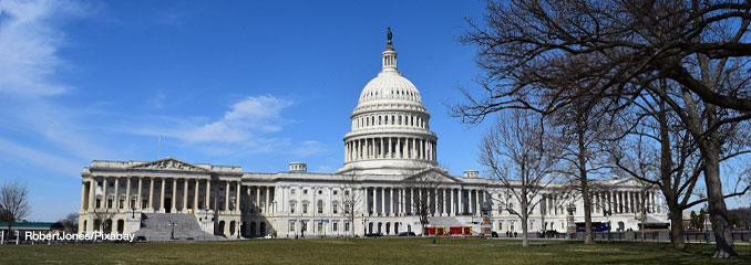
WASH DC FORECAST …
Monday: A chance of showers and thunderstorms, mainly after 4pm. Mostly sunny, with a high near 88. Light and variable wind. Chance of precipitation is 30%.
Monday Night: A chance of showers and thunderstorms, mainly before 7pm. Increasing clouds, with a low around 70. Light south wind. Chance of precipitation is 30%.
Tuesday: A chance of showers, then showers and possibly a thunderstorm after 11am. High near 86. South wind 6 to 11 mph, with gusts as high as 21 mph. Chance of precipitation is 100%. New rainfall amounts between a quarter and half of an inch possible.
Tuesday Night: Showers and thunderstorms before 11pm, then a chance of showers between 11pm and 2am. Low around 69. Southwest wind 5 to 7 mph becoming west after midnight. Chance of precipitation is 80%. New precipitation amounts between a tenth and quarter of an inch, except higher amounts possible in thunderstorms.
Wednesday: A slight chance of showers and thunderstorms after 2pm. Mostly sunny, with a high near 85. Northwest wind 9 to 13 mph, with gusts as high as 24 mph. Chance of precipitation is 20%.
Wednesday Night: Partly cloudy, with a low around 68.
Thursday: Mostly sunny, with a high near 85.
Thursday Night: Partly cloudy, with a low around 68.
Friday: Sunny, with a high near 88.
Friday Night: Partly cloudy, with a low around 70.
Saturday: A slight chance of showers and thunderstorms. Partly sunny, with a high near 89. Chance of precipitation is 20%.
Saturday Night: A slight chance of showers and thunderstorms. Mostly cloudy, with a low around 72. Chance of precipitation is 20%.
Baltimore/Washington DC Forecast
RADAR • Clouds • Temps • NWS Baltimore/Washington • UV
O’Hare Weather Forecast Compared to Phoenix, Miami, LA, Wash DC MON JUL 27, 2026 10:22 AM SOURCE: National Weather Service local offices.
