


CHICAGOLAND DETAILS …
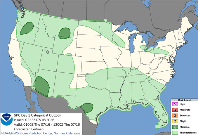
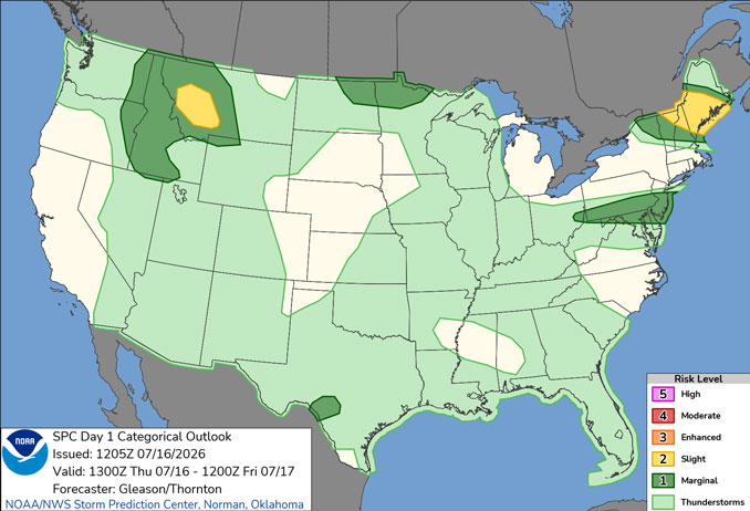
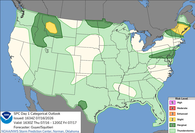
Radar was clear in northern Illinois Thursday morning and afternoon, July 16, 2026; however, a fluctuating but nearly stationary line began forming about 3:30 p.m. from west of Madison, Wisconsin to Elgin to Joliet and east of Kankakee. The part of the thunderstorm line near Elgin completely dissipated by 5:50 p.m.
A period of reduced visibility due to smoke is expected Thursday and Thursday night, generally along and northeast of Interstate 90. The Air Quality Index (AQI) at the Northbrook monitor reached 597 around 3:00 p.m. and 877 by about 4:30 p.m. and dropping to 648 by 6:15 p.m. All three readings are considered hazardous for healthy and unhealthy populations. The EPA’s AirNow.gov website recommended Thursday that everyone should stay indoors and reduce activity levels.
A few storms were possible Thursday afternoon but failed to develop near Arlington Heights. There are increased chances of storms Friday and then again late Saturday afternoon into Saturday evening.
Warm and humid conditions will continue into Saturday with peak heat indices around 100 degrees at times. Sunday drops to the low 80s, but Monday and Tuesday rise to the upper 80s.
See also: LIVE STREAMS: Arlingtoncardinal.com/StormChasers
Temperature Outlook …
F 74 95 | SA 75 90 | SU 68 82 | M 68 88
O’HARE FORECAST …
Air Quality Alert Thursday through Friday night
The Illinois Environmental Protection Agency has issued a Red Forecast Air Pollution Action Day for Friday July 17th for the AirNow AQI forecast sectors of Rockford and all 6 Chicago area forecast sectors. This is in addition to downgrade of the ongoing action day to a Purple Forecast Air Pollution Action Day in effect today.
These Purple and Red Forecast Air Pollution Action Days are declared due to a forecast of Very Unhealthy-Purple category particulates on Thursday July 16th and a forecast of Unhealthy-Red category particulates on Friday July 17th.
Northern Illlinois is on the edge of a thick plume of surface smoke blanketing the Great Lakes and Northeast U.S. While some models do suggest minor decreases in smoke/PM2.5 levels are possible today, they also suggest that the smoke wont significantly decrease until between mid-morning and mid-afternoon Friday. Forecasts for 24-hour AQI will remain in poor categories Friday even though condition may eventually improve. With this in mind, those with air quality concerns or outdoor plans are encouraged to check current NowCast readings or sign up for EnviroFlash alerts on AirNow.gov to aid in both identifying periods of poor AQI and periods of improving AQI.
AQI Category Guidance
Unhealthy – Everyone should reduce prolonged activities or heavy exertion outdoors. Active children, older adults, and people with pulmonary or respiratory disease such as asthma should avoid prolonged activities or heavy exertion outdoors.
Very Unhealthy – Sensitive groups: Avoid all physical activity outdoors. Reschedule to a time when air quality is better or move activities indoors. Everyone else: Avoid long or intense activities. Consider rescheduling or moving activities indoors. Note: If you don`t have an air conditioner, staying inside with the windows closed may be dangerous in extremely hot weather. If you are hot, go someplace with air conditioning or check with your local government to find out if cooling centers are available in your community.
Hazardous – Everyone: Avoid all physical activity outdoors.
Sensitive groups:
Remain indoors and keep activity levels low. Follow tips for keeping particle levels low indoors. Note: If you don`t have an air conditioner, staying inside with the windows closed may be dangerous in extremely hot weather. If you are hot, go someplace with air conditioning or check with your local government to find out if cooling centers are available in your community.
Thursday Afternoon and Evening: Widespread smoke, mainly before 3pm. Partly sunny, with a high near 90. East northeast wind 5 to 10 mph.
Thursday Night: Widespread smoke, mainly after 9pm. Mostly cloudy, with a low around 74. East wind around 5 mph becoming calm after midnight.
Friday: A 50 percent chance of showers and thunderstorms after noon. Widespread smoke, mainly before 10am. Partly sunny, with a high near 90. Heat index values as high as 95. Light and variable wind becoming west southwest 5 to 10 mph in the morning.
Friday Night: Mostly clear, with a low around 75. West southwest wind 5 to 10 mph.
Saturday: Showers and thunderstorms likely after 1pm. Mostly sunny, with a high near 90. West southwest wind 10 to 15 mph becoming north northwest in the afternoon. Winds could gust as high as 20 mph. Chance of precipitation is 70%.
Saturday Night: Mostly clear, with a low around 68.
Sunday: Sunny, with a high near 82.
Sunday Night: Mostly clear, with a low around 68.
Monday: Mostly sunny, with a high near 88.
Monday Night: A chance of showers and thunderstorms before 1am. Partly cloudy, with a low around 71.
Tuesday: Mostly sunny, with a high near 85.
Tuesday Night: Partly cloudy, with a low around 64.
RADAR • Clouds • Temps • NWS CHGO • UV

PHOENIX FORECAST …
AIR QUALITY ALERT OZONE HIGH POLLUTION ADVISORY FOR MARICOPA COUNTY INCLUDING THE PHOENIX METRO AREA THROUGH THURSDAY…
FLOOD WATCH REMAINS IN EFFECT THROUGH LATE THURSDAY NIGHT …
Thursday Afternoon: A 20 percent chance of showers and thunderstorms after 1pm. Mostly sunny, with a high near 102. South wind 5 to 10 mph becoming west.
Thursday Night: A chance of showers and thunderstorms, then showers likely and possibly a thunderstorm after 5am. Mostly cloudy, with a low around 81. Breezy, with a north northeast wind 5 to 15 mph becoming south southeast in the evening. Winds could gust as high as 25 mph. Chance of precipitation is 60%. New rainfall amounts between a tenth and quarter of an inch, except higher amounts possible in thunderstorms.
Friday: Showers and thunderstorms likely before 3pm, then a slight chance of showers and thunderstorms after 5pm. Partly sunny, with a high near 95. East northeast wind around 5 mph becoming southwest in the afternoon. Chance of precipitation is 60%. New rainfall amounts between a tenth and quarter of an inch, except higher amounts possible in thunderstorms.
Friday Night: A 30 percent chance of showers and thunderstorms, mainly after 3am. Mostly cloudy, with a low around 82. Calm wind.
Saturday: A 30 percent chance of showers and thunderstorms before 11am. Mostly sunny, with a high near 98. East wind around 5 mph becoming west southwest in the afternoon.
Saturday Night: A 30 percent chance of showers and thunderstorms after 11pm. Partly cloudy, with a low around 83. West southwest wind around 5 mph becoming calm.
Sunday: A 10 percent chance of showers and thunderstorms before 11am. Sunny, with a high near 100. West wind around 5 mph.
Sunday Night: A 30 percent chance of showers and thunderstorms, mainly after 11pm. Partly cloudy, with a low around 83. West wind around 5 mph becoming calm.
Monday: A 30 percent chance of showers and thunderstorms before 11am. Mostly sunny, with a high near 102. South wind around 5 mph becoming west in the afternoon.
Monday Night: A 30 percent chance of showers and thunderstorms. Mostly cloudy, with a low around 84. West southwest wind around 5 mph becoming calm in the evening.
Tuesday: A 30 percent chance of showers and thunderstorms. Mostly sunny, with a high near 102. Calm wind becoming west around 5 mph in the afternoon.
Tuesday Night: A 40 percent chance of showers and thunderstorms. Mostly cloudy, with a low around 84. North northwest wind around 5 mph becoming calm.
RADAR • Clouds • Temps • NWS Phoenix • UV

MIAMI FORECAST …
Heat Advisory in effect from July 16, 11:00 AM EDT until July 16, 07:00 PM EDT
Thursday Afternoon: Isolated showers and thunderstorms before 5pm. Partly sunny, with a high near 94. Heat index values as high as 106. Southeast wind around 8 mph. Chance of precipitation is 20%.
Thursday Night: Isolated showers and thunderstorms before 8pm. Partly cloudy, with a low around 81. Southwest wind 5 to 8 mph. Chance of precipitation is 10%.
Friday: Scattered showers and thunderstorms after 2pm. Mostly sunny, with a high near 93. Heat index values as high as 107. Light and variable wind becoming south 5 to 10 mph in the afternoon. Chance of precipitation is 50%. New rainfall amounts of less than a tenth of an inch, except higher amounts possible in thunderstorms.
Friday Night: Scattered showers and thunderstorms, mainly before 8pm. Partly cloudy, with a low around 80. South wind 3 to 8 mph. Chance of precipitation is 30%.
Saturday: Isolated showers and thunderstorms. Mostly sunny, with a high near 91. Southeast wind 5 to 11 mph. Chance of precipitation is 20%.
Saturday Night: Partly cloudy, with a low around 81. South wind around 7 mph.
Sunday: Scattered showers and thunderstorms, mainly after 2pm. Mostly sunny, with a high near 91. South wind 7 to 11 mph, with gusts as high as 18 mph. Chance of precipitation is 30%.
Sunday Night: Scattered showers and thunderstorms before 8pm. Partly cloudy, with a low around 81. South wind 7 to 9 mph. Chance of precipitation is 30%.
Monday: A 30 percent chance of showers and thunderstorms, mainly after 2pm. Mostly sunny, with a high near 92. South wind 7 to 13 mph, with gusts as high as 18 mph.
Monday Night: A 30 percent chance of showers and thunderstorms before 8pm. Partly cloudy, with a low around 81.
Tuesday: A 30 percent chance of showers and thunderstorms. Mostly sunny, with a high near 92.
Tuesday Night: A 30 percent chance of showers and thunderstorms. Mostly clear, with a low around 81.
RADAR • Clouds • Temps • NWS Miami • UV
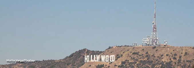
LAX FORECAST …
Heat Advisory until July 16, 08:00 PM PDT
Thursday Afternoon: Mostly sunny, with a high near 84. South southwest wind around 10 mph.
Thursday Night: Increasing clouds, with a low around 68. South wind around 10 mph becoming east southeast after midnight. Winds could gust as high as 15 mph.
Friday: Patchy fog before 11am. Otherwise, cloudy, then gradually becoming mostly sunny, with a high near 77. East southeast wind 10 to 15 mph becoming south in the afternoon.
Friday Night: Patchy fog after 11pm. Otherwise, mostly cloudy, with a low around 68. Southeast wind 10 to 15 mph, with gusts as high as 20 mph.
Saturday: Patchy fog before 11am. Otherwise, mostly sunny, with a high near 76. Southeast wind 5 to 15 mph becoming southwest in the afternoon.
Saturday Night: Patchy fog after 11pm. Otherwise, mostly cloudy, with a low around 66.
Sunday: Patchy fog before 11am. Otherwise, partly sunny, with a high near 76.
Sunday Night: Partly cloudy, with a low around 67.
Monday: Mostly sunny, with a high near 76.
Monday Night: Partly cloudy, with a low around 68.
Tuesday: Mostly sunny, with a high near 77.
Tuesday Night: Mostly clear, with a low around 68.
RADAR • Clouds • Temps • NWS Los Angeles • UV
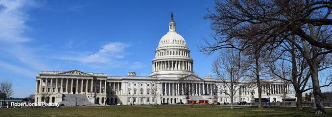
WASH DC FORECAST …
AIR QUALITY ALERT IS IN EFFECT FOR FRIDAY JULY 17 2026…
Heat Advisory until July 16, 08:00 PM EDT
Thursday Night: Isolated showers and thunderstorms before 10pm. Widespread smoke, mainly after 3am. Partly cloudy, with a low around 76. West wind 5 to 9 mph becoming northeast after midnight. Chance of precipitation is 20%.
Friday: Widespread smoke. Mostly sunny, with a high near 93. Calm wind becoming west around 5 mph in the afternoon.
Friday Night: A chance of showers and thunderstorms after 2am. Widespread smoke. Partly cloudy, with a low around 74. Southeast wind around 5 mph becoming calm in the evening. Chance of precipitation is 30%.
Saturday: A chance of showers and thunderstorms, then showers and possibly a thunderstorm after 2pm. Areas of smoke before noon. High near 92. Heat index values as high as 102. South wind 5 to 10 mph, with gusts as high as 21 mph. Chance of precipitation is 90%. New rainfall amounts between a quarter and half of an inch possible.
Saturday Night: Showers and possibly a thunderstorm before 2am, then a chance of showers and thunderstorms between 2am and 5am, then a chance of showers after 5am. Low around 75. West wind around 6 mph. Chance of precipitation is 80%.
Sunday: A chance of showers, with thunderstorms also possible after 11am. Mostly sunny, with a high near 88. Chance of precipitation is 30%.
Sunday Night: Mostly clear, with a low around 69.
Monday: Mostly sunny, with a high near 87.
Monday Night: A slight chance of showers after 2am. Partly cloudy, with a low around 71. Chance of precipitation is 20%.
Tuesday: A chance of showers, with thunderstorms also possible after 2pm. Partly sunny, with a high near 91. Chance of precipitation is 40%.
Tuesday Night: A chance of showers and thunderstorms. Mostly cloudy, with a low around 73. Chance of precipitation is 50%.
Wednesday: A chance of showers and thunderstorms. Mostly sunny, with a high near 88. Chance of precipitation is 30%.
Wednesday Night: A chance of showers and thunderstorms. Partly cloudy, with a low around 68. Chance of precipitation is 30%.
Baltimore/Washington DC Forecast
RADAR • Clouds • Temps • NWS Baltimore/Washington • UV
O’Hare Weather Forecast Compared to Phoenix, Miami, LA, Wash DC WED JUL 15, 2026 11:55 PM SOURCE: National Weather Service local offices.
