


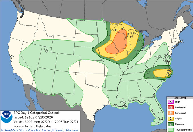
CHICAGOLAND DETAILS …
Radar indicates precipitation a large area of showers and thunderstorm entering Illinois from Iowa, Minnesota, and Wisconsin, and as far east as Rockford, Illinois. The storms are moving from northwest to southeast, but the most severe area of storms were near Cedar Rapids and Davenport, Iowa and heading toward Peoria at 10:50 a.m. Monday.
Light rain or sprinkles might reach Arlington Heights by about 12:15 p.m. or 12:30 p.m.
There remains a threat for severe weather today, but the severe weather may be mostly northwest or south of Arlington Heights and O’Hare International Airport.
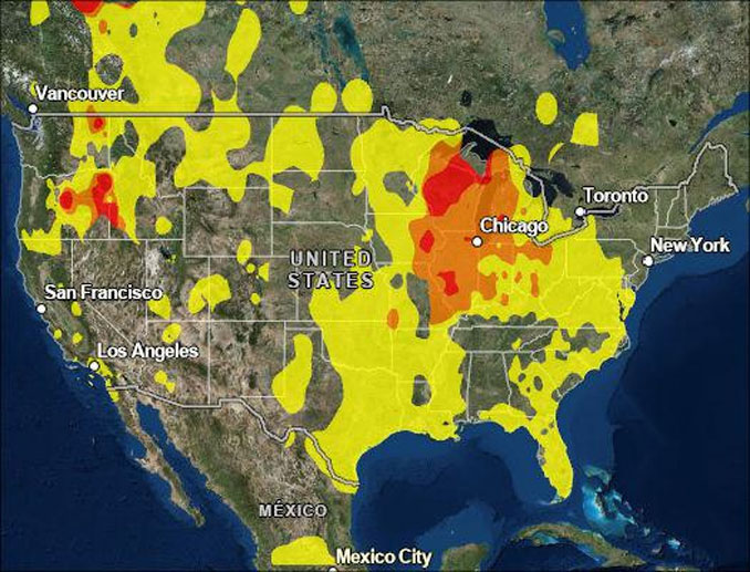
Air quality continues to be an issue in the area with an AQI of 126 (ORANGE: Unhealthy for Sensitive Groups/Pollutant PM2.5) at 10:50 a.m.
Air quality is forecast to improve Tuesday to Moderate levels (AQI 50 to 100)
A series of cold fronts will lead to cooler temperatures by midweek, for example a low of 60 Thursday morning.
See also: LIVE STREAMS: Arlingtoncardinal.com/StormChasers
Temperature Outlook …
T 72 86 | W 61 74 | R 60 80 | F 64 84
O’HARE FORECAST …
AIR QUALITY ALERT IN EFFECT NOW THROUGH MONDAY NIGHT
Monday: Isolated showers between 1pm and 2pm. Widespread smoke before 1pm. Cloudy early, then gradual clearing, with a high near 86. Southwest wind 10 to 15 mph, with gusts as high as 25 mph. Chance of precipitation is 20%.
Monday Night: Scattered showers and thunderstorms, mainly after 10pm. Partly cloudy, with a low around 72. Southwest wind 10 to 15 mph, with gusts as high as 25 mph. Chance of precipitation is 50%.
Tuesday: Isolated showers after 4pm. Mostly sunny, with a high near 86. West northwest wind 10 to 15 mph, with gusts as high as 25 mph. Chance of precipitation is 20%.
Tuesday Night: Isolated showers before 1am. Partly cloudy, with a low around 61. North wind 10 to 15 mph, with gusts as high as 25 mph. Chance of precipitation is 20%.
Wednesday: Sunny, with a high near 74. North wind around 10 mph, with gusts as high as 15 mph.
Wednesday Night: Mostly clear, with a low around 60.
Thursday: Sunny, with a high near 80.
Thursday Night: Partly cloudy, with a low around 64.
Friday: Mostly sunny, with a high near 84.
Friday Night: Mostly clear, with a low around 67.
Saturday: Sunny, with a high near 87.
Saturday Night: Mostly clear, with a low around 69.
RADAR • Clouds • Temps • NWS CHGO • UV

PHOENIX FORECAST …
Monday: Sunny, with a high near 104. West wind 5 to 10 mph.
Monday Night: A 30 percent chance of showers and thunderstorms, mainly between 11pm and midnight. Increasing clouds, with a low around 86. West southwest wind 5 to 10 mph becoming east in the evening. Winds could gust as high as 25 mph.
Tuesday: A 30 percent chance of showers and thunderstorms, mainly before 10am. Mostly cloudy, then gradually becoming sunny, with a high near 103. West wind around 5 mph.
Tuesday Night: A 20 percent chance of showers and thunderstorms. Mostly cloudy, with a low around 86. Northwest wind around 5 mph becoming calm in the evening.
Wednesday: Mostly sunny, with a high near 104. East wind around 5 mph becoming calm.
Wednesday Night: A 20 percent chance of showers and thunderstorms before 11pm. Partly cloudy, with a low around 89. Calm wind becoming northeast around 5 mph.
Thursday: Sunny, with a high near 109. East northeast wind around 5 mph becoming calm.
Thursday Night: A 10 percent chance of showers and thunderstorms before 11pm. Mostly clear, with a low around 91. Calm wind.
Friday: Sunny and hot, with a high near 110. Calm wind becoming west around 5 mph in the afternoon.
Friday Night: A 10 percent chance of showers and thunderstorms before 11pm. Partly cloudy, with a low around 91. West wind around 5 mph becoming calm in the evening.
Saturday: Sunny and hot, with a high near 112. Calm wind becoming west around 5 mph in the afternoon.
Saturday Night: Mostly clear, with a low around 91. West southwest wind around 5 mph becoming calm in the evening.
RADAR • Clouds • Temps • NWS Phoenix • UV

MIAMI FORECAST …
Heat Advisory in effect from July 20, 11:00 AM EDT until July 20, 07:00 PM EDT
Monday Afternoon: A 20 percent chance of showers and thunderstorms before 2pm. Mostly sunny, with a high near 91. Heat index values as high as 108. South wind around 15 mph, with gusts as high as 23 mph.
Monday Night: Partly cloudy, with a low around 82. South wind 8 to 10 mph.
Tuesday: Mostly sunny, with a high near 92. Heat index values as high as 105. Southeast wind around 11 mph.
Tuesday Night: Partly cloudy, with a low around 81. Southeast wind around 7 mph.
Wednesday: Sunny, with a high near 92. Southeast wind 6 to 10 mph.
Wednesday Night: Mostly clear, with a low around 81. East wind around 7 mph.
Thursday: Sunny, with a high near 92. East wind 5 to 11 mph.
Thursday Night: A 20 percent chance of showers and thunderstorms after 2am. Mostly clear, with a low around 81. East wind 6 to 9 mph.
Friday: A 30 percent chance of showers and thunderstorms, mainly after 2pm. Sunny, with a high near 91. Southeast wind 5 to 10 mph.
Friday Night: A 30 percent chance of showers and thunderstorms before 8pm. Mostly clear, with a low around 81.
Saturday: A 30 percent chance of showers and thunderstorms. Sunny, with a high near 92.
Saturday Night: A 30 percent chance of showers and thunderstorms. Partly cloudy, with a low around 81.
RADAR • Clouds • Temps • NWS Miami • UV
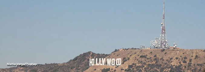
LAX FORECAST …
High Surf Advisory until July 21, 11:00 PM PDT
Monday: Partly sunny, with a high near 78. West southwest wind 5 to 15 mph.
Monday Night: Mostly cloudy, with a low around 68. West southwest wind 5 to 15 mph.
Tuesday: Mostly sunny, with a high near 78. South wind 5 to 15 mph becoming west southwest in the afternoon. Winds could gust as high as 20 mph.
Tuesday Night: Partly cloudy, with a low around 68. South southwest wind 5 to 15 mph.
Wednesday: Sunny, with a high near 80. Southwest wind 5 to 10 mph increasing to 10 to 15 mph in the afternoon. Winds could gust as high as 20 mph.
Wednesday Night: Mostly clear, with a low around 68.
Thursday: Sunny, with a high near 82.
Thursday Night: Mostly clear, with a low around 69.
Friday: Sunny, with a high near 79.
Friday Night: Mostly clear, with a low around 69.
Saturday: Mostly sunny, with a high near 80.
Saturday Night: Mostly clear, with a low around 69.
RADAR • Clouds • Temps • NWS Los Angeles • UV
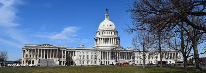
WASH DC FORECAST …
Monday Afternoon: Mostly sunny, with a high near 89. Southeast wind 5 to 7 mph.
Monday Night: A chance of showers and thunderstorms, mainly after 3am. Increasing clouds, with a low around 71. South wind 3 to 7 mph. Chance of precipitation is 30%.
Tuesday: A chance of showers and thunderstorms before 2pm, then showers and possibly a thunderstorm between 2pm and 5pm, then showers and thunderstorms likely after 5pm. High near 90. Southwest wind 5 to 10 mph, with gusts as high as 20 mph. Chance of precipitation is 80%. New rainfall amounts between a quarter and half of an inch possible.
Tuesday Night: Showers and thunderstorms likely, then showers and possibly a thunderstorm after 8pm. Low around 72. Southwest wind 7 to 9 mph, with gusts as high as 20 mph. Chance of precipitation is 90%. New rainfall amounts between a half and three quarters of an inch possible.
Wednesday: A chance of showers, with thunderstorms also possible after 2pm. Mostly cloudy, with a high near 87. West wind 6 to 9 mph. Chance of precipitation is 50%.
Wednesday Night: A chance of thunderstorms before 8pm. Mostly cloudy, with a low around 65. Chance of precipitation is 30%.
Thursday: Sunny, with a high near 82.
Thursday Night: Mostly clear, with a low around 64.
Friday: Mostly sunny, with a high near 80.
Friday Night: A slight chance of showers and thunderstorms before 2am. Mostly cloudy, with a low around 67. Chance of precipitation is 20%.
Saturday: Partly sunny, with a high near 81.
Saturday Night: Partly cloudy, with a low around 68.
Baltimore/Washington DC Forecast
RADAR • Clouds • Temps • NWS Baltimore/Washington • UV
O’Hare Weather Forecast Compared to Phoenix, Miami, LA, Wash DC MON JUL 20, 2026 10:47 AM SOURCE: National Weather Service local offices.
