
CHICAGOLAND DETAILS …
Radar indicates precipitation indicates thunderstorm over most of northern Illinois. The expected severe weather was observed approaching the Mississippi River at about 2:00 p.m.
Another round or two of severe storms are expected today with the period of greatest threat between 4 and 11 PM. All hazards (tornadoes, destructive winds, destructive hail) are possible across the entire area.
In particular, there is a threat for strong to intense tornadoes this evening (4 to 8 PM) especially along and north of Interstate 88.
Temperature forecasts have increase for today, Friday, and Saturday.
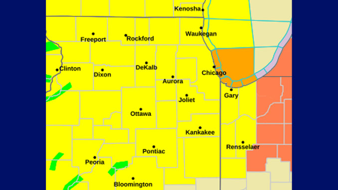
WATCHES, WARNINGS, ADVISORIES
Tornado Warning
Flood Watch
See also: LIVE STREAMS: Arlingtoncardinal.com/StormChasers
O’HARE FORECAST …
Tornado Watch
TORNADO WATCH 313 IS IN EFFECT FROM 155 PM UNTIL 900 PM CDT FOR THE FOLLOWING LOCATIONS
ADAMS, BOONE, BROWN
BUREAU, CARROLL, CASS
COOK, DE KALB, DE WITT
DUPAGE, FORD, FULTON
GRUNDY, HANCOCK, HENDERSON
HENRY, IROQUOIS, JO DAVIESS
KANE, KANKAKEE, KENDALL
KNOX, LAKE, LA SALLE
LEE, LIVINGSTON, LOGAN
MARSHALL, MASON, MCDONOUGH
MCHENRY, MCLEAN, MENARD
MERCER, MORGAN, OGLE
PEORIA, PIKE, PUTNAM
ROCK ISLAND, SANGAMON, SCHUYLER
SCOTT, STARK, STEPHENSON
TAZEWELL, WARREN, WHITESIDE
WILL, WINNEBAGO, WOODFORD
Flood Watch
FLOOD WATCH REMAINS IN EFFECT UNTIL 11 PM CDT THIS EVENING…
Thursday Afternoon: Showers likely and possibly a thunderstorm before 2pm, then a chance of showers and thunderstorms after 2pm. Some of the storms could be severe and produce heavy rainfall. Partly sunny, with a high near 85. Breezy, with a south wind 15 to 20 mph, with gusts as high as 30 mph. Chance of precipitation is 70%. New rainfall amounts between a quarter and half of an inch possible.
Thursday Night: Showers and thunderstorms, mainly before 10pm. Some of the storms could be severe and produce heavy rainfall. Low around 60. Breezy, with a south wind 15 to 20 mph becoming west 10 to 15 mph after midnight. Winds could gust as high as 35 mph. Chance of precipitation is 90%. New precipitation amounts between three quarters and one inch possible.
Friday: Sunny, with a high near 80. West wind 10 to 15 mph, with gusts as high as 25 mph.
Friday Night: Mostly clear, with a low around 63. Southwest wind 5 to 10 mph, with gusts as high as 15 mph.
Saturday: Sunny, with a high near 84. Southwest wind 10 to 15 mph, with gusts as high as 25 mph.
Saturday Night: Showers and possibly a thunderstorm before 4am, then showers likely. Low around 61. Chance of precipitation is 90%.
Sunday: Mostly sunny, with a high near 72.
Sunday Night: Mostly clear, with a low around 55.
RADAR • Clouds • Temps • NWS CHGO • UV
O’Hare Weather Forecast SOURCE: National Weather Service local offices.
