
CHICAGOLAND DETAILS …
Radar indicates precipitation as thunderstorms and tornadoes … rotation in South Elgin, Wayne, Wheaton, and Yorkville.
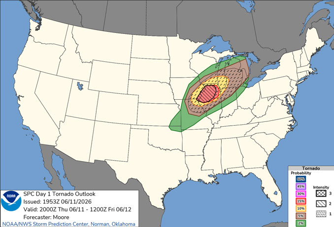
Severe storms likely through this evening (highest threat between 5 and 10 PM). All hazards (tornadoes, destructive winds, significant hail) are possible across the entire area.
After a dry and cooler day on Friday, there is another threat for severe weather late Saturday.
See also: LIVE STREAMS: Arlingtoncardinal.com/StormChasers
O’HARE FORECAST …
FLOOD WATCH REMAINS IN EFFECT UNTIL 11 PM CDT THIS EVENING
Tornado Watch until 9:00 PM
Thursday Night: Showers and thunderstorms, mainly before 10pm. Some of the storms could be severe and produce heavy rainfall. Low around 60. Breezy, with a south southwest wind 15 to 20 mph becoming west 10 to 15 mph after midnight. Winds could gust as high as 30 mph. Chance of precipitation is 90%. New precipitation amounts between a half and three quarters of an inch possible.
Friday: Sunny, with a high near 80. West wind 10 to 15 mph, with gusts as high as 25 mph.
Friday Night: Mostly clear, with a low around 63. Southwest wind 5 to 10 mph, with gusts as high as 15 mph.
Saturday: Sunny, with a high near 84. Southwest wind 10 to 15 mph, with gusts as high as 25 mph.
Saturday Night: Showers and possibly a thunderstorm before 4am, then showers likely. Low around 61. Southwest wind around 10 mph becoming northwest after midnight. Winds could gust as high as 20 mph. Chance of precipitation is 90%.
Sunday: Mostly sunny, with a high near 72.
Sunday Night: Mostly clear, with a low around 55.
Monday: Sunny, with a high near 75.
Monday Night: Partly cloudy, with a low around 56.
RADAR • Clouds • Temps • NWS CHGO • UV
O’Hare Weather Forecast JUN 11, 2026 7:40 PM SOURCE: National Weather Service local offices.
