


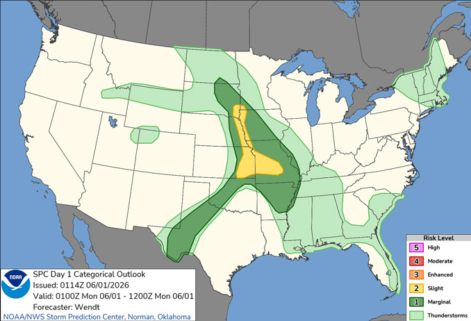
CHICAGOLAND DETAILS …
Some light showers or sprinkles possible tonight, most areas not likely to receive more than a couple of hundredths of an inch of precip. Radar indicates a line of precipitation from Rensselaer, Indiana; to Elgin, Illinois; to Janesville, Wisconsin; to Minneapolis-St Paul, Minnesota at 11:45 p.m.
Generally dry conditions expected through much of the upcoming work week with the next appreciable rain chances not until Friday into next weekend.
See also: LIVE STREAMS: Arlingtoncardinal.com/StormChasers
O’HARE FORECAST …
Overnight Sunday/Monday: Isolated showers. Cloudy, with a low around 57 around midnight. Northeast wind around 5 mph. Chance of precipitation is 20%.
Monday: Isolated showers before 10am, then isolated sprinkles between 10am and 4pm. Mostly cloudy, with a high near 74 about 3pm to 4pm. Northeast wind 5 to 10 mph. Chance of precipitation is 20%.
Monday Night: Mostly clear, with a low around 55. Northeast wind 5 to 10 mph.
Tuesday: Sunny, with a high near 76. East northeast wind 5 to 15 mph.
Tuesday Night: Clear, with a low around 55. Northeast wind 5 to 10 mph becoming light after midnight. Winds could gust as high as 15 mph.
Wednesday: Sunny, with a high near 82.
Wednesday Night: Mostly clear, with a low around 62.
Thursday: Mostly sunny, with a high near 87.
Thursday Night: Mostly cloudy, with a low around 68.
RADAR • Clouds • Temps • NWS CHGO • UV

PHOENIX FORECAST …
Overnight Sunday/Monday: Clear, with a low around 73. Calm wind.
Monday: Sunny, with a high near 102. Calm wind becoming west around 5 mph in the afternoon.
Monday Night: Mostly clear, with a low around 75. West wind around 5 mph becoming calm after midnight.
Tuesday: Sunny, with a high near 103. Calm wind becoming west around 5 mph in the afternoon.
Tuesday Night: Clear, with a low around 74. West wind around 5 mph becoming calm after midnight.
Wednesday: Sunny, with a high near 103. Calm wind becoming west around 5 mph in the afternoon.
Wednesday Night: Mostly clear, with a low around 75. West wind around 5 mph becoming calm after midnight.
Thursday: Sunny, with a high near 102. Calm wind becoming west around 5 mph in the afternoon.
Thursday Night: Clear, with a low around 74. West southwest wind 5 to 10 mph becoming light and variable after midnight.
RADAR • Clouds • Temps • NWS Phoenix • UV

MIAMI FORECAST …
Overnight Sunday/Monday: Mostly cloudy, with a low around 78. Light southwest wind.
Monday: A 50 percent chance of showers and thunderstorms, mainly after 2pm. Partly sunny, with a high near 90. Heat index values as high as 103. Light and variable wind becoming south 5 to 7 mph in the afternoon. New rainfall amounts between a tenth and quarter of an inch, except higher amounts possible in thunderstorms.
Monday Night: A 30 percent chance of showers and thunderstorms before 8pm. Mostly cloudy, with a low around 78. Southwest wind around 6 mph.
Tuesday: Showers likely and possibly a thunderstorm between 2pm and 5pm, then showers and thunderstorms likely after 5pm. Increasing clouds, with a high near 90. Heat index values as high as 100. Northwest wind 3 to 6 mph. Chance of precipitation is 60%.
Tuesday Night: Showers and thunderstorms likely, mainly before 8pm. Mostly cloudy, with a low around 77. West wind around 5 mph. Chance of precipitation is 60%.
Wednesday: A chance of showers, then showers and thunderstorms likely after 11am. Cloudy, with a high near 86. Northeast wind 3 to 6 mph. Chance of precipitation is 70%.
Wednesday Night: Showers and thunderstorms likely before 8pm, then showers likely and possibly a thunderstorm between 8pm and 2am, then a chance of showers and thunderstorms after 2am. Cloudy, with a low around 76. Northeast wind around 7 mph. Chance of precipitation is 60%.
Thursday: A chance of showers and thunderstorms, then showers likely and possibly a thunderstorm after 8am. Mostly cloudy, with a high near 84. East wind 7 to 11 mph, with gusts as high as 18 mph. Chance of precipitation is 70%.
Thursday Night: A 40 percent chance of showers. Mostly cloudy, with a low around 76. East wind around 10 mph.
RADAR • Clouds • Temps • NWS Miami • UV
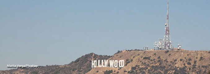
LAX FORECAST …
Overnight Sunday/Monday: Patchy fog after 11pm. Otherwise, mostly clear early, then becoming cloudy, with a low around 61. West southwest wind 5 to 10 mph becoming south after midnight.
Monday: Patchy fog before 11am. Otherwise, cloudy, then gradually becoming mostly sunny, with a high near 72. Southeast wind 5 to 10 mph becoming southwest in the afternoon. Winds could gust as high as 15 mph.
Monday Night: Patchy fog after 11pm. Otherwise, increasing clouds, with a low around 61. West southwest wind 5 to 10 mph becoming southeast after midnight. Winds could gust as high as 15 mph.
Tuesday: Patchy fog before 11am. Otherwise, cloudy through mid morning, then gradual clearing, with a high near 71. South southeast wind 5 to 15 mph becoming west southwest in the afternoon.
Tuesday Night: Patchy fog after 11pm. Otherwise, mostly cloudy, with a low around 60. West southwest wind 5 to 10 mph becoming light and variable in the evening.
Wednesday: Patchy fog before 11am. Otherwise, mostly sunny, with a high near 71.
Wednesday Night: Mostly clear, with a low around 60.
Thursday: Mostly sunny, with a high near 71.
Thursday Night: Partly cloudy, with a low around 60.
RADAR • Clouds • Temps • NWS Los Angeles • UV
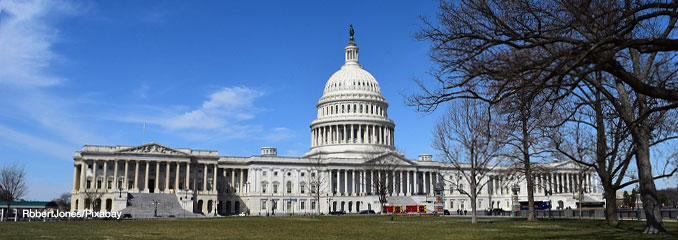
WASH DC FORECAST …
Overnight Sunday/Monday: A chance of sprinkles. Partly cloudy, with a low around 61. Light south wind.
Monday: Partly sunny, with a high near 79. North wind 6 to 9 mph.
Monday Night: Partly cloudy, with a low around 54. East wind around 7 mph.
Tuesday: Sunny, with a high near 76. Northeast wind 5 to 7 mph.
Tuesday Night: Mostly clear, with a low around 57. Light northwest wind.
Wednesday: Sunny, with a high near 81.
Wednesday Night: Clear, with a low around 60.
Thursday: Sunny, with a high near 86.
Thursday Night: Mostly clear, with a low around 64.
RADAR • Clouds • Temps • NWS Baltimore/Washington • UV
O’Hare Weather Forecast Compared to Phoenix, Miami, LA, Washington DC SUN MAY 31, 2026 11:16 PM
