
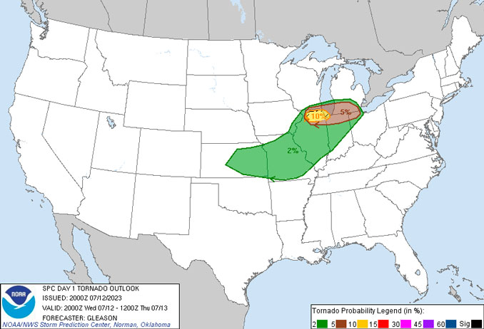
According to the National Weather Service Chicago, there is a threat for strong tornadoes Wednesday evening, July 12, 2023.
A recent hand surface analysis places a compact meso-low pressure system centered near Gutenberg, Iowa just north of a surface warm front stretching from near Dubuque, Iowa southeastward across Freeport, Aurora, and Valparaiso. Meanwhile, a cold front stretches from near Galena, Illinois to Washington, Iowa. Ahead of the Mesoscale convective vortex (MCV) and south of the warm front, filtered sunshine within an airmass characterized by pooling surface dew points in the lower 70s is leading to quickly- increasing instability with RAP- analyzed MLCAPE (Mean Layer values of temperature and moisture for Convective Available Potential Energy) already exceeding 1000 J/kg ahead of the cold front.
Meanwhile, augmented flow around the periphery of the MCV is leading to a strongly sheared low- to mid- level kinematic environment, with both the KLOT/KDVN VWPs showing some 50 kt of 0-6km shear. In fact, locally backed winds along the warm front is contributing to nearly 40kt of 0-500m shear and 250+ J/kg of 0-500m Storm-Relative Helicity (SRH) roughly from Rockford to Romeoville. Such high values of low-level SRH are relatively rare for our local area for this time of year.
Over the next few hours, explosive thunderstorm development appears likely near the Mississippi River with the favorable thermodynamic and kinematic parameter space supporting a quick evolution into several supercells, according to the National Weather Service. Damaging winds and hail are likely with any storm. Perhaps more concerning, Bunker`s right storm motion along the warm front will provide unusually long residence times within the high-magnitude low-level SRH environment, supporting an unusually high threat for episodic strong tornadoes (EF2+) for our local area. Extrapolating the location of the warm front, such a threat appears highest from near Rockford to the Chicago metropolitan areas between 4 and 8 PM CDT.
Stay weather aware this afternoon and evening. Have multiple ways to get warnings. And, be ready to take cover in the most interior, lowest level of your building.
Weather Radar shows a line of storms between Dubuque and Rockford that is heading toward Chicagoland.
See also Arlingtoncardinal.com/clouds
A tornado watch has been issued for parts of Illinois and Indiana until 10 PM CDT pic.twitter.com/GoV6drhJwD
— NWS Chicago (@NWSChicago) July 12, 2023
TORNADO WATCH …
TORNADO WATCH OUTLINE UPDATE FOR WT 477 NWS STORM PREDICTION CENTER NORMAN OK 350 PM CDT WED JUL 12 2023
TORNADO WATCH 477 IS IN EFFECT UNTIL 1000 PM CDT FOR THE FOLLOWING LOCATIONS … ILLINOIS COUNTIES INCLUDED ARE …
BOONE, COOK, DE KALB, DUPAGE, GRUNDY, KANE, KANKAKEE, KENDALL, LAKE LA SALLE, LEE, MCHENRY, OGLE, STEPHENSON, WILL, WINNEBAGO
O’HARE FORECAST …
Flood Watch
Tornado Watch
This Afternoon: A chance of showers and thunderstorms, then showers and possibly a thunderstorm after 4pm. Some of the storms could produce heavy rain. High near 74. South southeast wind around 10 mph, with gusts as high as 15 mph. Chance of precipitation is 80%. New rainfall amounts between a quarter and half of an inch possible.
Tonight: Showers and thunderstorms, mainly before 9pm. Low around 65. West southwest wind 5 to 10 mph becoming north northwest in the evening. Winds could gust as high as 15 mph. Chance of precipitation is 80%. New precipitation amounts between a tenth and quarter of an inch, except higher amounts possible in thunderstorms.
Thursday: A 20 percent chance of showers and thunderstorms after 1pm. Partly sunny, with a high near 80. Northwest wind around 5 mph.
Thursday Night: Mostly clear, with a low around 66. South southwest wind around 5 mph.
Friday: A slight chance of showers, then a chance of showers and thunderstorms after 10am. Mostly sunny, with a high near 87. West southwest wind 5 to 10 mph, with gusts as high as 15 mph. Chance of precipitation is 50%.
Friday Night: Showers likely and possibly a thunderstorm. Mostly cloudy, with a low around 69. Chance of precipitation is 60%.
Saturday: A 50 percent chance of showers and thunderstorms. Mostly sunny, with a high near 84.
Saturday Night: Mostly clear, with a low around 67.
Sunday: A chance of showers after 1pm. Sunny, with a high near 84.
Sunday Night: A chance of showers. Partly cloudy, with a low around 66.
Monday: A chance of showers. Mostly sunny, with a high near 81.
Monday Night: Mostly clear, with a low around 63.
Tuesday: Sunny, with a high near 83.
LAKE TEMPS …
SOUTHERN LAKE MICHIGAN WATER TEMPERATURES
NATIONAL WEATHER SERVICE CHICAGO/ROMEOVILLE IL
923 AM CDT Wed Jul 12 2023
LAKE MICHIGAN WATER TEMPERATURES…
CHICAGO SHORE………..69.
CHICAGO CRIB…………68.
CHICAGO BUOY…………70.
WILMETTE BUOY………..69.
WAUKEGAN BUOY………..68.
WINTHROP HARBOR BUOY….65.
MICHIGAN CITY………..64.
MICHIGAN CITY BUOY……70.
SOUTH MID LAKE BUOY…..66.
CENTRAL MID LAKE BUOY…65.
NORTH MID LAKE BUOY…..63.
&&
M IS FOR MISSING DATA THAT IS NORMALLY AVAILABLE.
THE MICHIGAN CITY WATER TEMPERATURE SENSOR IS LOCATED AT A WATER
INTAKE ONE MILE OFFSHORE AND 60 FEET BELOW WATER SURFACE. IT IS READ
EVERY DAY OF THE YEAR.
july.chicagoweatherstation.com
Chicago Weather Forecast for your MAC/PC/TABLET includes surrounding suburbs.
^^ MOBILE? USE VOICE MIC ^^
facebook …
Please ‘LIKE’ the ‘Arlington Cardinal Page. See all of The Cardinal Facebook fan pages at Arlingtoncardinal.com/about/facebook …
Help fund The Cardinal Arlingtoncardinal.com/sponsor
20240105-1435future
