
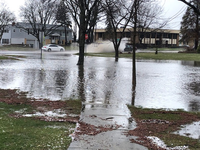
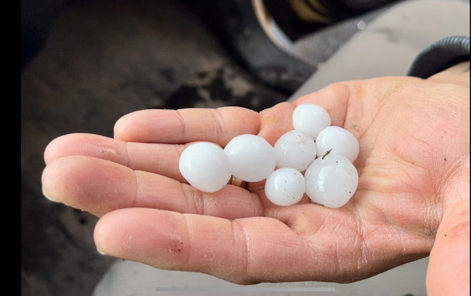
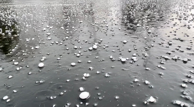
A thunderstorm cell with heavy rain, hail and a little lightning passed through Rolling Meadows and Arlington Heights and other nearby communities about 1:45 p.m. Tuesday, April 4, 2023. The storm started slow with moderate rain. Heavy rain arrived with small hail with a few up to .75 inch diameter. The heavy rain lasted less than a one-half hour and full rain period lasted less than one hour. A 2.4-inch rainfall measurement was reported in Rolling Meadows. Thunderstorm winds were not significant with the National Weather Service office at O’Hare International Airport reporting25 to 29 MPH gust around the time a thunderstorm cell passed Arlington Heights.
Some flooding occurred as the ground is highly saturated and a large amount of rain fell in a short period of time.
A Severe Thunderstorm Warning was activated which has expired, and then a Wind Advisory was activated at 3:42 p.m. Tuesday for Wednesday, and is in effect from 7:00 a.m. CDT to 4:00 p.m. CDT Wednesday.
Gusty winds could blow around unsecured objects. Tree limbs could be blown down and a few power outages may result. Travel will be hazardous for high profile vehicles.
Along with the strong non-thunderstorm winds, strong to severe thunderstorms may produce wind gusts of 50 to 60 mph or greater Wednesday morning through early afternoon.
The next best chance for thunderstorms near Arlington Heights and nearby communities is 6:00 p.m. to 11:00 p.m. Tuesday, and 10:00 a.m. to 12:00 p.m. Wednesday. While the temperatures rise to 68°F overnight with a warm front. By the early-mid afternoon, a sharpening warm frontal zone will be gradually pushing across our area, although lake influences will undoubtedly curtail its northward progress.
This will set the stage for an exceptional temperature gradient in the area this afternoon, with 40s/near 50 degree near the WI state line and upper 70s and even a few 80 degree readings south of I-80. To the north of the front, low clouds, intermittent drizzle, and even some fog pushing in off the lake seem plausible. By mid-afternoon, it`s very possible the south side of Chicago will be in the warm sector while the north side is still stuck with low clouds and southeast winds off the lake.
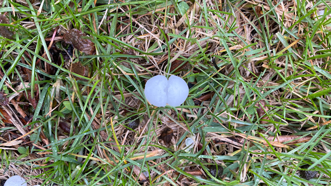
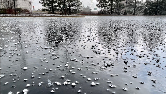
There was more hail in Deerfield, and there was also a more hail the size of about a nickel to a quarter.
Weather Radar shows this first round of thunderstorms has passed Chicagoland to the northeast.
Weather Radar in northeast Illinois was clear.
See also Arlingtoncardinal.com/clouds
O’HARE FORECAST …
Tuesday Afternoon: A 20 percent chance of showers and thunderstorms after 4pm. Cloudy, with a high near 64. East southeast wind around 15 mph, with gusts as high as 25 mph.
Tuesday Night: A chance of showers and thunderstorms before 2am, then a slight chance of showers and thunderstorms after 3am. Mostly cloudy, with a temperature rising to around 68 by 1am. Breezy, with a southeast wind 15 to 25 mph becoming south southwest after midnight. Winds could gust as high as 30 mph. Chance of precipitation is 40%.
Wednesday: Showers and thunderstorms likely, mainly between 10am and 1pm. Partly sunny, with a temperature rising to near 71 by 10am, then falling to around 56 during the remainder of the day. Windy, with a south wind 20 to 30 mph, with gusts as high as 40 mph. Chance of precipitation is 60%. New rainfall amounts between a tenth and quarter of an inch, except higher amounts possible in thunderstorms.
Wednesday Night: Mostly clear, with a low around 34. Breezy, with a west wind 20 to 25 mph, with gusts as high as 35 mph.
Thursday: Sunny, with a high near 52. Breezy, with a west wind 15 to 20 mph, with gusts as high as 25 mph.
Thursday Night: Clear, with a low around 35.
Friday: Sunny, with a high near 52.
Friday Night: Partly cloudy, with a low around 38.
Saturday: Mostly sunny, with a high near 61.
Saturday Night: Mostly clear, with a low around 45.
Sunday: Mostly sunny, with a high near 68.
kl
Sunday Night: A chance of showers. Mostly cloudy, with a low around 51.
Monday: Mostly sunny, with a high near 65.
april.chicagoweatherstation.com
Chicago Weather Forecast for your MAC/PC/TABLET includes surrounding suburbs.
^^ MOBILE? USE VOICE MIC ^^
facebook …
Please ‘LIKE’ the ‘Arlington Cardinal Page. See all of The Cardinal Facebook fan pages at Arlingtoncardinal.com/about/facebook …
Help fund The Cardinal Arlingtoncardinal.com/sponsor
20240105-1435future
