
Wet snow is expected to fall late Friday and Saturday with deeper accumulations trending from north of I-88 to the Illinois-Wisconsin state line. However, as is often the case, there is uncertainty with the track of the snowstorm. A stationary front stems from a broad center of high pressure seated in the north-central Texas area. The associated upper trough sits just south of the desert southwest over the Gulf of California region. Through the day Friday, the trough will dig as it progresses eastward into the southern Plains with a strengthening jet max on its leeward (downwind) side. The setup for cyclonic activity will cause a steadily deepening surface low moving northeastward across the Ozark Plateau and up into southern Illinois by Friday evening.
A swath of rain showers is expected to develop across the cyclone`s northern periphery and begin moving into southern Chicagoland by late this afternoon, and reach areas near the Illinois-Wisconsin stateline by late evening. Overnight Friday/Saturday, steady cooling aloft will begin to introduce some snow. Snow will begin to mix in across northwestern Chicagoland during the latter part of the overnight into the early morning hours Saturday. The Rockford metro and vicinity is expected to see all snow by daybreak Saturday. The footprint of snow will then expand southeastward through the morning as the cold advection ramps up behind the low. Precipitation will then fizzle away to the northeast Saturday afternoon, according to NWS Chicago.
As far as snow totals go, several inches appear probable across the far northern and northwestern Chicagoland, particularly about 4-7 inches near the state line (e.g., Antioch). Fox Lake is in the 3-5 inch range, Long Grove is in the 2-4 inch range, and Arlington Heights is in the 1-3 inch range. Snow rates during the early morning could reach up to an inch per hour if not even a bit higher at times. Thermal profiles favor a heavy, wet snow, especially for the first few hours with snow-liquid ratios as low as 5-8:1 prior to daybreak. There is potential for heavy bands of snow. Any heavier snow bands that do develop could result in snow rates in excess of 1.5 inches per hour, potentially resulting in locally higher amounts. Another challenge when forecasting snow totals is the uncertainty still revolving around the exact track of this storm. How close the low pressure center wants to pass by Chicagoland will play a big role in which areas see the deepest snow.
Weather Radar shows precipitation moving northwest with the leading edge near St. Louis at 12:55 p.m. Friday.
Weather Radar in northeast Illinois was clear.
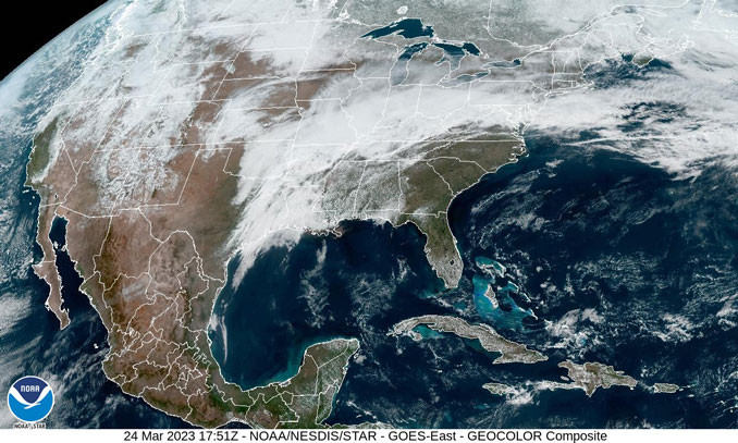
See also Arlingtoncardinal.com/clouds
Rain this evening will transition to snow across areas near and north of I-88 late tonight into early tomorrow. Several inches of snow accumulation are possible across parts of extreme northern Illinois. Exercise caution if you encounter snow on the roads tonight and tomorrow. pic.twitter.com/3fTuNRAekF
— NWS Chicago (@NWSChicago) March 24, 2023
FOX LAKE FORECAST …
Winter Weather Advisory
Hazardous Weather Outlook
This Afternoon: Partly sunny, with a high near 45. East wind around 15 mph.
Tonight: Rain likely before 1am, then rain and snow. Low around 32. East northeast wind 10 to 15 mph, with gusts as high as 30 mph. Chance of precipitation is 100%. New snow accumulation of 1 to 3 inches possible.
Saturday: Snow before 1pm, then snow likely, possibly mixed with rain. The snow could be heavy at times. High near 37. North northeast wind around 15 mph becoming west northwest in the afternoon. Winds could gust as high as 30 mph. Chance of precipitation is 90%. New snow accumulation of 3 to 5 inches possible.
Saturday Night: Mostly cloudy, then gradually becoming mostly clear, with a low around 24. West wind 5 to 10 mph, with gusts as high as 20 mph.
Sunday: Mostly sunny, with a high near 44. West northwest wind 5 to 10 mph becoming north northeast in the afternoon.
Sunday Night: Mostly cloudy, with a low around 28.
Monday: Partly sunny, with a high near 43.
Monday Night: Mostly cloudy, with a low around 29.
Tuesday: Mostly sunny, with a high near 46.
Tuesday Night: Partly cloudy, with a low around 29.
Wednesday: Partly sunny, with a high near 46.
Wednesday Night: A chance of showers. Mostly cloudy, with a low around 32.
Thursday: A chance of showers. Partly sunny, with a high near 50.
Winter Weather Advisory
URGENT – WINTER WEATHER MESSAGE
National Weather Service Chicago IL
1036 AM CDT Fri Mar 24 2023
Counties: Winnebago-Boone-McHenry-Lake IL-Ogle- Including the cities of Rockford, Belvidere, Crystal Lake, Algonquin, McHenry, Woodstock, Waukegan, Buffalo Grove, Mundelein, Gurnee, Rochelle, Oregon, and Byron 1036 AM CDT Fri Mar 24 2023
…WINTER WEATHER ADVISORY REMAINS IN EFFECT FROM 4 AM TO 1 PM CDT SATURDAY…
* WHAT…Accumulating wet snow expected. Total snow accumulations of 4 to 7 inches, with locally higher amounts possible.
* WHERE…Winnebago, Boone, McHenry, Lake (IL), and Ogle Counties.
* WHEN…From 4 AM to 1 PM CDT Saturday.
* IMPACTS…Untreated roads will become covered with slushy snow accumulations and travel may become difficult for a period early Saturday morning during the period of heaviest snow.
* ADDITIONAL DETAILS…Snow rates are likely to peak at 1 to 1.5 inches per hour late tonight into early Saturday morning. The expected heavy, wet nature of the snow will make shoveling hazardous.
PRECAUTIONARY/PREPAREDNESS ACTIONS…
Slow down and use caution while traveling.
The latest road conditions for Illinois can be obtained on the internet at www.gettingaroundillinois.com.
SOUTHERN LAKE MICHIGAN WATER TEMPERATURES NATIONAL WEATHER SERVICE CHICAGO/ROMEOVILLE IL 902 AM CDT Fri Mar 24 2023
LAKE MICHIGAN WATER TEMPERATURES…
CHICAGO SHORE……….40.
CHICAGO CRIB………..40.
MICHIGAN CITY……….37.
&&
M IS FOR MISSING DATA THAT IS NORMALLY AVAILABLE.
THE MICHIGAN CITY WATER TEMPERATURE SENSOR IS LOCATED AT A WATER INTAKE ONE MILE OFFSHORE AND 60 FEET BELOW WATER SURFACE. IT IS READ EVERY DAY OF THE YEAR.
march.chicagoweatherstation.com
Chicago Weather Forecast for your MAC/PC/TABLET includes surrounding suburbs.
^^ MOBILE? USE VOICE MIC ^^
facebook …
Please ‘LIKE’ the ‘Arlington Cardinal Page. See all of The Cardinal Facebook fan pages at Arlingtoncardinal.com/about/facebook …
Help fund The Cardinal Arlingtoncardinal.com/sponsor
20240105-1435future
