
A Winter Weather Advisory remains in effect until 1:00 p.m. in the northern tier counties of Illinois and upward to Wisconsin.
There was significant uncertainty Thursday night whether precipitation in Chicagoland and northern Illinois would be predominantly snow or rain. Early Friday morning at about 3:30 a.m. the predominant form of precipitation in the forecast was leaning toward rain mixed with snow. Any four-inch accumulation or even three-inch accumulation is likely to occur in Wisconsin, not Illinois. Two to three inches of snow accumulation might occur just south of the Illinois-Wisconsin state line, but even that much snow in the forecast, especially on paved surfaces, is low confidence.
At 6:15 a.m. not much precipitation was showing up on Lake County PASSAGE cameras. Many roads look dry. IL 120 at Fairfield looks wet at 6:28 a.m. Gilmer Road and Ellis Road in Volo was showing initial snow accumulation by about 7:35 a.m.
NWS Chicago is forecasting that cooling aloft will bring snow after daybreak — beginning about 7:00 a.m. to 8:00 a.m. The hourly graph predicts 2.8 inches for Antioch from about 8:00 a.m. to 2:00 p.m., but the ECMF is forecasting 2.2 inches for the area and the GFS is forecasting 2.7 inches at the Illinois-Wisconsin state line. Cardinal News is betting on about 2 inches or less — even near the Illinois-Wisconsin state line.
Only 0.6 inch of snow is forecast for Arlington Heights from 7:00 am. to 12 noon. Friday. Little or no snow accumulation is expected on pavement, roadways, and sidewalks, etc.
The air temperature in Arlington Heights was 36°F, and 37°F at O’Hare at 6:00 a.m. Air temperature is forecast to be steady and increase a little after 5:00 p.m.
Weather Radar showed precipitation cross the Mississippi River from Iowa to Illinois overnight. While precipitation is advancing toward northeast Illinois, the snow and frozen precipitation had a vector toward southern Wisconsin, and overall the precipitation did not look robust. Snow popped up on radar over Lake County and McHenry County about 5:45 a.m., but the precipitation band is about half-way through the area from front to back. There might not be much snow at all if that band doesn’t see a backfill development during the day today. The trailing edge of the precipitation moving southwest to northeast is between Ottawa and Peoria, and closer to Ottawa at 6:30 a.m. There is nothing developing behind the band at 6:30 a.m.
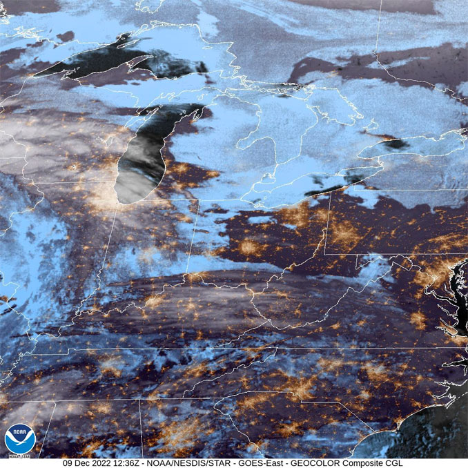
See also Arlingtoncardinal.com/clouds
Accumulating wet snow will impact travel across parts of northern IL this AM, particularly north of I-88. Plan for travel impacts and delays after 8am this morning, leave yourself extra commute time. #ilwx #inwx pic.twitter.com/xfgn262QdF
— NWS Chicago (@NWSChicago) December 9, 2022
URGENT – WINTER WEATHER MESSAGE National Weather Service Chicago IL 336 AM CST Fri Dec 9 2022
Winnebago-Boone-McHenry-Lake IL- Including the cities of Rockford, Belvidere, Crystal Lake, Algonquin, McHenry, Woodstock, Waukegan, Buffalo Grove, Mundelein, and Gurnee 336 AM CST Fri Dec 9 2022
…WINTER WEATHER ADVISORY REMAINS IN EFFECT UNTIL 1 PM CST THIS AFTERNOON…
* WHAT…A period of heavy, wet snow expected. Total snow accumulations of 2 to 4 inches.
* WHERE…Winnebago, Boone, McHenry and Lake IL Counties.
* WHEN…Until 1 PM CST this afternoon.
* IMPACTS…Expect periods of sharply reduced visibilities and hazardous travel due to slushy snow accumulations. The hazardous conditions will likely impact portions of the morning commute.
* ADDITIONAL DETAILS…Temperatures are expected to warm above freezing through the late morning and afternoon with road conditions likely to quickly improve as snow ends.
PRECAUTIONARY/PREPAREDNESS ACTIONS…
Slow down and use caution while traveling.
The latest road conditions for Illinois can be obtained on the internet at www.gettingaroundillinois.com.
O’HARE FORECAST …
Overnight: A 40 percent chance of rain. Cloudy, with a low around 34. East wind around 10 mph, with gusts as high as 20 mph.
Friday: Rain and snow, possibly mixed with sleet before noon, then rain and snow between noon and 3pm, then rain likely after 3pm. Steady temperature around 35. East wind 10 to 15 mph, with gusts as high as 20 mph. Chance of precipitation is 100%. New snow and sleet accumulation of less than one inch possible.
Friday Night: A chance of drizzle, mainly before midnight. Patchy fog. Otherwise, cloudy, with a low around 36. East wind 5 to 10 mph, with gusts as high as 15 mph.
Saturday: A slight chance of drizzle before noon, then a chance of drizzle with a slight chance of rain between noon and 3pm, then a chance of rain or drizzle after 3pm. Patchy fog before 8am. Otherwise, cloudy, with a high near 40. East southeast wind around 5 mph, with gusts as high as 15 mph. Chance of precipitation is 30%.
Saturday Night: A 20 percent chance of rain or drizzle before midnight. Mostly cloudy, with a low around 35. Southeast wind around 5 mph becoming northwest after midnight.
Sunday: Mostly cloudy, with a high near 43.
Sunday Night: Mostly cloudy, with a low around 34.
Monday: Mostly cloudy, with a high near 41.
Monday Night: Mostly cloudy, with a low around 33.
Tuesday: A chance of rain after noon. Mostly cloudy, with a high near 45.
Tuesday Night: Rain. Cloudy, with a low around 37.
Wednesday: Rain likely. Mostly cloudy, with a high near 46.
Wednesday Night: A chance of rain. Mostly cloudy, with a low around 32.
Thursday: A chance of rain and snow. Mostly cloudy, with a high near 39.
LAKE TEMPS …
SOUTHERN LAKE MICHIGAN WATER TEMPERATURES
NATIONAL WEATHER SERVICE CHICAGO/ROMEOVILLE IL
905 AM CST Thu Dec 8 2022
LAKE MICHIGAN WATER TEMPERATURES…
CHICAGO SHORE……….40.
CHICAGO CRIB……….39.
MICHIGAN CITY……….42.
&&
M IS FOR MISSING DATA THAT IS NORMALLY AVAILABLE.
THE MICHIGAN CITY WATER TEMPERATURE SENSOR IS LOCATED AT A WATER
INTAKE ONE MILE OFFSHORE AND 60 FEET BELOW WATER SURFACE. IT IS READ
EVERY DAY OF THE YEAR.
december.chicagoweatherstation.com
Chicago Weather Forecast for your MAC/PC/TABLET includes surrounding suburbs.
^^ MOBILE? USE VOICE MIC ^^
facebook …
Please ‘LIKE’ the ‘Arlington Cardinal Page. See all of The Cardinal Facebook fan pages at Arlingtoncardinal.com/about/facebook …
Help fund The Cardinal Arlingtoncardinal.com/sponsor
20240105-1435future
