
Cold temperatures and high winds are forecast concerns for Friday and overnight Friday/Saturday …
- Gusty SW winds 35-45mph this afternoon turning NW this evening
- Potential for blowing and drifting snow in open areas
- Snow showers/squalls potential along the front this evening
Wind chills -5 to -15 degrees late tonight into early Saturday
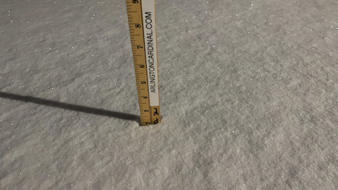
In the wake of the latest winter storm, the weather pattern remains active to end the workweek as a potent clipper system drives southeast across the Upper Midwest and Great Lakes region. In advance of this system, warm advection returns in full force with a 50+ kt low-level jet developing overhead. By mid-late afternoon some of these higher gusts will begin to mix down to the surface. At this time, confidence is highest in areas that are mostly snow cover free (i.e. out toward Rockford) seeing the highest gusts where a Wind Advisory has been issued accordingly where gusts may reach or possibly briefly exceed 45 mph. Areas with snow may help limit the mixing somewhat and hold wind gusts down. Still expecting gusts in the 30-40mph range across much of the area (which is still gusty and especially chilling). The winds forecast have cause increasing concerns of blowing and drifting snow during the afternoon and evening hours, especially in open and rural areas. Confidence in how widespread this becomes is on the lower side, but if it appears it will become more widespread and hazardous a Winter Weather Advisory for blowing snow may need to be considered. For now have covered this with an SPS.
Beyond this afternoon, the aforementioned clipper system will swing a strong cold front across the area this evening. Weather conditions along this front upstream of here are favorable for the development of snow squalls as it sweeps across the Upper Midwest toward the local area. We will have the benefit of being able to monitor conditions upstream on its approach but current thinking is that the snow squall intensity will be on a downward trend on its approach as the instability/positive buoyancy decreases with sunset. The timing of the front pushing across the area is expected roughly between 6-10pm CST. Areas northwest of the Chicago metro near the WI/IL stateline stand the best chance of seeing one of these snow squalls accompanied by bursts of heavy snow and sudden visibility reductions. It is quite possible that the squall erodes before reaching Illinois, but with snow squalls being a fairly high impact weather event, opted to err on the side of caution.
The warm advection during the day will help temperatures warm into the upper 20s and lower 30s today but the gusty winds over the snow pack will make it feel more like the teens. Temperatures then dip into the single digits for most areas tonight with wind chills between -5 and -15 possible toward daybreak Saturday. Northwest winds, albeit much lighter, on Saturday will limit our warming, with highs only in the lower 20s.
Weather Radar in northeast Illinois was clear at 5:45 a.m.
See also Arlingtoncardinal.com/clouds
Here's a look at the next few days. Snow winds down tonight. We'll turn windy tomorrow with gusts upwards of 40 to even 45 mph. Scattered gusty snow showers are possible Friday evening, primarily N of I-80. Watching another potential for winter weather Mon-Mon Night #ILwx #INwx pic.twitter.com/wdHYp7ys0P
— NWS Chicago (@NWSChicago) February 18, 2022
O’HARE FORECAST …
Today: Patchy blowing snow after 1pm. Sunny, with a high near 31. Wind chill values as low as -2. Breezy, with a west wind 10 to 15 mph becoming south southwest 15 to 20 mph in the afternoon. Winds could gust as high as 40 mph.
Tonight: A 50 percent chance of snow showers, mainly before 10pm. Patchy blowing snow. Mostly cloudy, then gradually becoming mostly clear, with a low around 9. Wind chill values as low as -8. Breezy, with a southwest wind 20 to 25 mph becoming west northwest after midnight. Winds could gust as high as 40 mph.
Saturday: Sunny, with a high near 22. Wind chill values as low as -10. Blustery, with a west northwest wind 15 to 20 mph becoming west 10 to 15 mph in the afternoon. Winds could gust as high as 30 mph.
Saturday Night: Partly cloudy, with a low around 16. Breezy, with a south southwest wind 10 to 15 mph increasing to 15 to 20 mph after midnight. Winds could gust as high as 30 mph.
Sunday: Mostly sunny, with a high near 44. Breezy, with a south southwest wind 15 to 25 mph, with gusts as high as 35 mph.
Sunday Night: Mostly cloudy, with a low around 32.
Washington’s Birthday: A 20 percent chance of rain after noon. Mostly cloudy, with a high near 40.
Monday Night: Rain likely, possibly mixed with snow before 7pm, then rain. Cloudy, with a low around 35.
Tuesday: Rain likely before 3pm, then rain and snow likely. Cloudy, with a high near 36.
Tuesday Night: A chance of snow before midnight. Cloudy, with a low around 20.
Wednesday: Partly sunny, with a high near 26.
Wednesday Night: Mostly cloudy, with a low around 17.
Thursday: A slight chance of snow. Mostly cloudy, with a high near 27.
LAKE TEMPS …
SOUTHERN LAKE MICHIGAN WATER TEMPERATURES
NATIONAL WEATHER SERVICE CHICAGO/ROMEOVILLE IL
904 AM CST Thu Feb 17 2022
LAKE MICHIGAN WATER TEMPERATURES…
CHICAGO SHORE………34.
CHICAGO CRIB……….34.
MICHIGAN CITY……….34.
&&
M IS FOR MISSING DATA THAT IS NORMALLY AVAILABLE.
THE MICHIGAN CITY WATER TEMPERATURE SENSOR IS LOCATED AT A WATER
INTAKE ONE MILE OFFSHORE AND 60 FEET BELOW WATER SURFACE. IT IS READ EVERY DAY OF THE YEAR.
february.chicagoweatherstation.com
Chicago Weather Forecast for your MAC/PC/TABLET includes surrounding suburbs.
^^ MOBILE? USE VOICE MIC ^^
facebook …
Please ‘LIKE’ the ‘Arlington Cardinal Page. See all of The Cardinal Facebook fan pages at Arlingtoncardinal.com/about/facebook …
Help fund The Cardinal Arlingtoncardinal.com/sponsor
20240105-1435future
