
A Winter Storm Warning was expanded this afternoon to include northern Cook County, Kane County and Lake County associated with a slight southward adjustment of the heavier snow axis and also the possibility of 0.1 to 0.2 inch ice accumulations overnight with sleet and freezing rain.
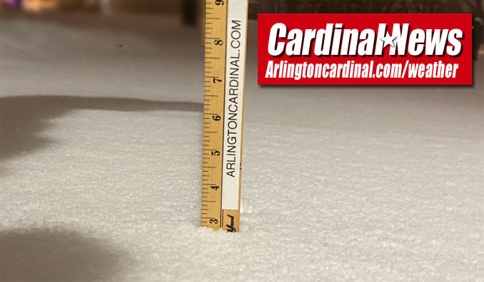
Arlington Heights could get another 2.5 inches by midnight on top of 2.75 inches of snow that has already fallen … for a total of 5.25 inches. Much of the snow will melt or turn to slush Wednesday morning.
Weather Radar) shows precipitation moving southwest to northeast over all of northeast Illinois at 6:00 p.m.
Moderate to briefly heavy snow is ongoing across much of northern Illinois and northwest Indiana. The snowfall intensity will diminish after 7pm, but chances of mixed precipitation will increase through the remainder of the evening. pic.twitter.com/O3SBnquoZm
— NWS Chicago (@NWSChicago) December 29, 2020
Here is a look at various webcams across the area as of 4:30pm. Moderate to briefly heavy snow continues across northern Illinois, with hazardous travel conditions across much of the area. Expect the higher snowfall rates to continue into the early evening. pic.twitter.com/DTLrRPp3ak
— NWS Chicago (@NWSChicago) December 29, 2020
This 20 minute time lapse from College of DuPage (Glen Ellyn) shows how quickly conditions are deteriorating across the Chicago metro this afternoon. Snowfall Rates of 1" to locally 2" per hour will continue through 6-7pm. pic.twitter.com/a7dAUXG3T2
— NWS Chicago (@NWSChicago) December 29, 2020
Dangerous travel conditions are developing as a band of heavy snow spreads over northern Illinois. While snow rates will taper between 7-8 PM, a change to freezing rain will occur by midnight. Here's a look at updated snow and ice totals (dangerous travel regardless of amounts). pic.twitter.com/jYC5AXQ3Wi
— NWS Chicago (@NWSChicago) December 29, 2020
O’HARE FORECAST …
⛄ National Weather Service Chicago Winter Weather Advisory⛄ 310 PM CST Tue Dec 29 2020…Several Inches of Snow and Some Freezing Rain Expected Mid to
Late This Afternoon Through Early Wednesday Morning…
DuPage-La Salle-Kendall-Central Cook-Southern Cook-Northern Will-Including the cities of Arlington Heights, Naperville, Wheaton, Downers Grove, Lombard, Carol Stream, Ottawa, Streator, La Salle, Mendota, Marseilles, Oswego, Yorkville, Plano, Chicago, Cicero, Oak Lawn, Oak Park, La Grange, Calumet City, Oak Forest, Lemont, Orland Park, Park Forest, Joliet, Bolingbrook, Plainfield,
and Mokena 310 PM CST Tue Dec 29 2020…WINTER WEATHER ADVISORY REMAINS IN EFFECT UNTIL 9 AM CST WEDNESDAY…
⛄ National Weather Service Chicago Winter Storm Warning⛄
310 PM CST Tue Dec 29 2020…Several Inches of Snow and Some Freezing Rain Expected Mid to Late This Afternoon Through Early Wednesday Morning… Winnebago-Boone-McHenry-Lake IL-Ogle-Lee-De Kalb-Kane-Including the cities of Rockford, Belvidere, Crystal Lake, Algonquin, McHenry, Woodstock, Waukegan, Buffalo Grove, Mundelein, Gurnee, Rochelle, Oregon, Byron, Dixon, DeKalb, Sycamore, Aurora, and Elgin 310 PM CST Tue Dec 29 2020 …WINTER STORM WARNING REMAINS IN EFFECT UNTIL 9 AM CST WEDNESDAY…
Tonight: Snow, freezing rain, and sleet before 3am, then freezing rain between 3am and 4am, then rain after 4am. The snow could be heavy at times. Temperature rising to around 33 by 4am. Breezy, with a southeast wind 15 to 20 mph, with gusts as high as 30 mph. Chance of precipitation is 100%. Total nighttime ice accumulation of around a 0.1 of an inch possible. Total nighttime snow and sleet accumulation of 2 to 4 inches possible.
Wednesday: Rain and snow, mainly before 11am. Temperature rising to near 38 by 10am, then falling to around 30 during the remainder of the day. West wind 10 to 15 mph, with gusts as high as 30 mph. Chance of precipitation is 100%. New snow accumulation of less than a half inch possible.
Wednesday Night: Mostly cloudy, with a low around 21. West northwest wind 5 to 15 mph, with gusts as high as 20 mph.
Thursday: Partly sunny, with a high near 33. West northwest wind around 5 mph becoming calm.
Thursday Night: A 40 percent chance of snow after 1am. Mostly cloudy, with a low around 28. East wind 5 to 15 mph.
New Year’s Day: Snow and freezing rain, possibly mixed with rain and sleet before 11am, then rain, possibly mixed with freezing rain between 11am and 1pm, then rain after 1pm. High near 40. Breezy. Chance of precipitation is 90%.
Friday Night: Rain, possibly mixed with snow before 3am, then a slight chance of snow. Low around 30. Chance of precipitation is 90%.
Saturday: A slight chance of snow before 7am. Partly sunny, with a high near 36.
Saturday Night: Mostly cloudy, with a low around 23.
Sunday: Mostly sunny, with a high near 35.
Sunday Night: Partly cloudy, with a low around 27.
Monday: Partly sunny, with a high near 41.
Monday Night: Mostly cloudy, with a low around 31.
Tuesday: Partly sunny, with a high near 42.
LAKE TEMPS …
SOUTHERN LAKE MICHIGAN WATER TEMPERATURES
NATIONAL WEATHER SERVICE CHICAGO/ROMEOVILLE IL
949 AM CST Tue Dec 29 2020
LAKE MICHIGAN WATER TEMPERATURES…
CHICAGO SHORE……….40.
CHICAGO CRIB……….38.
MICHIGAN CITY……….37.
NORTH MID LAKE BUOY……….43.
&&
M IS FOR MISSING DATA THAT IS NORMALLY AVAILABLE.
THE MICHIGAN CITY WATER TEMPERATURE SENSOR IS LOCATED AT A WATER
INTAKE ONE MILE OFFSHORE AND 60 FEET BELOW WATER SURFACE. IT IS READ
EVERY DAY OF THE YEAR.
december.chicagoweatherstation.com
Chicago Weather Forecast for your MAC/PC/TABLET includes surrounding suburbs.
^^ MOBILE? USE VOICE MIC ^^
facebook …
Please ‘LIKE’ the ‘Arlington Cardinal Page. See all of The Cardinal Facebook fan pages at Arlingtoncardinal.com/about/facebook …
Help fund The Cardinal Arlingtoncardinal.com/sponsor
20240105-1435future
