NWS CHGO | NWS HRLY | /NWSchicago | 🌡
ARLINGTON HEIGHTS WEATHER
▴ forecast7 (Arl. Hts.) | RADAR | WIDE RADAR
⏪ Hrly Data Table | Hrly Future Graph ⏩
IMPORTANT NOTE ON NWS DATA
⏪ Hrly Data Table | Hrly Future Graph ⏩
Hello mobile users! If you encounter a mobile “unfriendly” weather page, turn your phone sideways for a better view.
======================
Tuesday and Tuesday Evening …
No Weather Hazards …
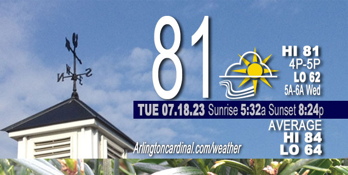
Mostly sunny, with a high near 81. North northwest wind 5 to 15 mph becoming east northeast. Winds could gust as high as 20 mph.
DISCUSSION…
A dry post-frontal airmass is in place and high pressure will continue to build in overhead, suppressing any convection well to our south and west. A fairly robust lake breeze will press inland this morning and afternoon, holding immediate lakeside temperatures in the mid-upper 70s, with near-80 degree readings elsewhere.
======================
O’HARE FORECAST …
Forecast Beginning Tuesday, July 18, 2023
Tuesday: Mostly sunny, with a high near 81. North northwest wind 5 to 15 mph becoming east northeast. Winds could gust as high as 20 mph.
Tuesday Night: Mostly clear, with a low around 62. East wind 5 to 10 mph becoming light in the evening.
Wednesday: Mostly sunny, with a high near 87. East southeast wind around 5 mph.
Wednesday Night: A 30 percent chance of showers and thunderstorms after 1am. Partly cloudy, with a low around 68. East southeast wind 5 to 10 mph becoming southwest after midnight.
Thursday: A 40 percent chance of showers and thunderstorms before 4pm. Mostly sunny, with a high near 89. Southwest wind 5 to 15 mph becoming west northwest in the afternoon. Winds could gust as high as 25 mph.
Thursday Night: Partly cloudy, with a low around 65.
Friday: Mostly sunny, with a high near 82.
Friday Night: Partly cloudy, with a low around 62.
Saturday: Sunny, with a high near 85.
Saturday Night: Partly cloudy, with a low around 64.
Sunday: A chance of showers and thunderstorms. Mostly sunny, with a high near 86.
Sunday Night: A chance of showers and thunderstorms. Partly cloudy, with a low around 66.
Monday: A chance of showers and thunderstorms. Mostly sunny, with a high near 87.

If you don’t see data below this blue header, you are viewing today’s current weather while the full day’s data is not complete; O’Hare forecast archive and hourly weather observations archive are available HERE on the CARDINAL NEWS Magazine …


CHICAGOWEATHERSTATION.COM
ChicagoWeatherStation.com I O’Hare Normal Temps/Precip I O’Hare Record Temps, Precip, Snow
WunderMap® with Temperature/Wind Data || Google: Arlington Heights Area Temps | US TEMPS
Midwest Cloud Cover with Arlington Heights Weather Forecast
ChicagoWeatherStation.com I O’Hare Normal Temps/Precip I O’Hare Record Temps, Precip, Snow
SUNLIGHT DATA FOR SECURITY, TRAFFIC SAFETY, AND SPORTS
SunCalc.net data with solar azimuth and trajectory, times for dawn, sunrise, solar noon, sunset, dusk …
NIGHT SKY THIS MONTH …
Backyard stargazers get a monthly guide to the northern hemisphere’s skywatching events with “Tonight’s Sky.” Check the night sky objects for this month and past months in the playlist from the Space Telescope Science Institute YouTube channel (Musical track The Far River written by Jonn Serrie, from the album And the Stars Go With You courtesy of New World Music Ltd).
Get updates from The Cardinal ALL NEWS FEEDS on Facebook. Just ‘LIKE’ the ‘Arlington Cardinal Page (become a fan of our page). The updates cover all posts and sub-category posts from The Cardinal — Arlingtoncardinal.com. You can also limit feeds to specific categories. See all of The Cardinal Facebook fan pages at Arlingtoncardinal.com/about/facebook …
Help fund The Cardinal Arlingtoncardinal.com/sponsor
/////////////>
Area Forecast Discussion
National Weather Service Chicago/Romeoville, IL
603 AM CDT Tue Jul 18 2023
.SHORT TERM… Issued at 209 AM CDT Tue Jul 18 2023
Through Wednesday…
There are no significant weather concerns during the short term part of the forecast. A dry post-frontal airmass is in place and high pressure will continue to build in overhead, suppressing any convection well to our south and west. A fairly robust lake breeze will press inland this morning and afternoon, holding immediate lakeside temperatures in the mid-upper 70s, with near-80 degree readings elsewhere. Looking like we`ll build a fairly healthy cumulus field as daytime PBL mixing into the base of a 6-8 kft layer of lingering moisture ensues.
A fairly energetic disturbance will pivot across Minnesota and Wisconsin tonight into Wednesday morning, but aside from tossing some additional mid-level cloud cover our way, this should pass through sans fanfare in our region. 925 mb temperature climo suggests–with sufficient insolation–upper 80s/near 90 degree readings should be attainable on Wednesday and have boosted highs a bit to better reflect this.
Carlaw/NWS Chicago

