Weather
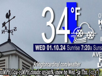
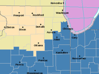
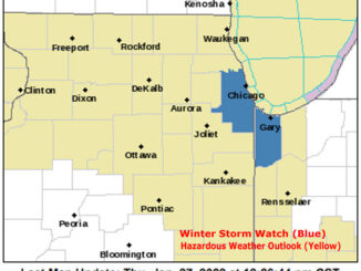
WINTER STORM WATCH, 20-30% Chance of True Blizzard Criteria Overnight Friday and Saturday
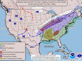
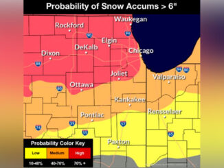
…WINTER STORM WATCH IN EFFECT FROM FRIDAY MORNING THROUGH SATURDAY MORNING… first issued at 2:18 p.m. Wednesday, January 10, 2024. Beginning Thursday/Friday about midnight and lasting through Saturday, a major winter storm with heavy snow […]